|
search place name
|
||
Nkolmélok (Cameroon)Nkolmélok is a town in Cameroon. An overview map of the region around Nkolmélok is displayed below.
regional and 3d topo map of Nkolmélok, Cameroon ::

Nkolmélok airports ::
The nearest airport is YAO - Yaounde Ville, located 46.2 km south of Nkolmélok.
Other airports nearby include FOM - Foumban Nkounja (172.7 km north west), BFX - Bafoussam (188.3 km north west), DLA - Douala (195.9 km west), BPC - Bamenda (247.7 km north west), Nearby towns ::
Lébamzip I (2.6km north east) //
Nkolntsa (2.6km north east) //
Nkolméyos (2.6km north east) //
Edzen (3.7km north) //
Ngongo (4.1km south east) //
Ntsaékang (4.1km south east) //
Nkolbibak (5.2km north east) //
Nkoltomo II (5.2km south west) //
Ko (5.2km south west) //
Nlongonambélé (5.5km west) //
Nkolvé (5.9km north) //
Loua II (5.9km south) //
Nkolzomo (5.8km west) //
Ngomo (5.8km west) //
Yémékout (5.9km south) //
Nkolékono (5.9km north) //
Abel (6.7km north west) //
Mingama (7.4km east) //
Éfok (7.4km south) //
Nkolondogo (7.6km east) //
Lépopomo (7.6km east) //
Mban (7.6km east) //
Loua I (7.6km south) //
Nkolzoa (7.6km north) //
Tsek (7.6km south) //
Ékalan Minkou (7.9km north west) //
Mbélé (7.9km south east) //
Nkolzomo (7.9km north east) //
Polo I (8.3km north west) //
[all distances 'as the bird flies' and approximate] 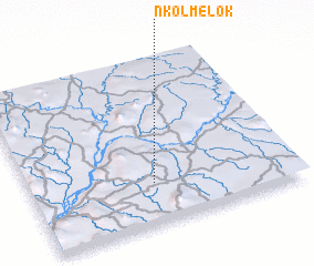 Places with similar names to Nkolmélok, Cameroon :: Disclaimer :: Information on this page comes without warranty of any kind |
||
|
Where is Nkolmélok? Elevation and coordinates ::
Latitude (lat): 4°15'0"N Longitude (lon): 11°28'0"E
Elevation (approx.): 590m (map arrows pan, magnifying glasses zoom) |
||
|
Visiting Nkolmélok? Hotel/Accommodation ::
Book a hotel in Nkolmélok Travel Guide ::
Buy a travel guide for Cameroon rental cars ::
car rental offers GPS waypoint ::
download a GPX waypoint (PoI) of Nkolmélok for your GPS receiver
|
||