|
search place name
|
||
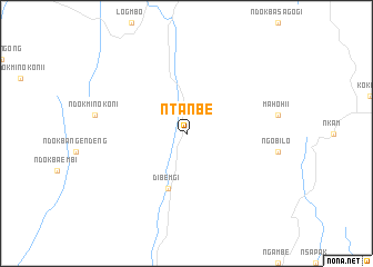
Ntanbe (Cameroon)Ntanbe is a town in Cameroon. An overview map of the region around Ntanbe is displayed below.
regional and 3d topo map of Ntanbe, Cameroon ::
Ntanbe airports ::
The nearest airport is DLA - Douala, located 98.0 km south west of Ntanbe.
Other airports nearby include YAO - Yaounde Ville (123.8 km south east), BFX - Bafoussam (132.7 km north), TKC - Tiko (133.4 km west), FOM - Foumban Nkounja (144.3 km north), Nearby towns ::
Dibemgi (5.9km south) //
[all distances 'as the bird flies' and approximate] 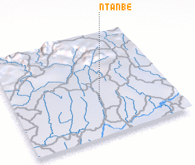 Places with similar names to Ntanbe, Cameroon ::
// Ndinbou (SN)
// Ntan Obu (NG)
// Na Dúnaibh (IE)
// Newtownabbey (GB)
// Na Dôn (1) (VN)
// Na Don (1) (VN)
// Na Tinh (1) (VN)
// Nadanbo (CN)
Disclaimer :: Information on this page comes without warranty of any kind |
||
|
Where is Ntanbe? Elevation and coordinates ::
Latitude (lat): 4°21'0"N Longitude (lon): 10°32'0"E
Elevation (approx.): 304m (map arrows pan, magnifying glasses zoom) |
||
|
Visiting Ntanbe? Hotel/Accommodation ::
Book a hotel in Ntanbe Travel Guide ::
Buy a travel guide for Cameroon rental cars ::
car rental offers GPS waypoint ::
download a GPX waypoint (PoI) of Ntanbe for your GPS receiver
|
||