|
search place name
|
||
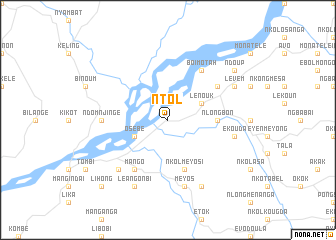
Ntol (Cameroon)Ntol is a town in Cameroon. An overview map of the region around Ntol is displayed below.
regional and 3d topo map of Ntol, Cameroon ::
Ntol airports ::
The nearest airport is YAO - Yaounde Ville, located 60.5 km south east of Ntol.
Other airports nearby include DLA - Douala (156.6 km west), FOM - Foumban Nkounja (164.0 km north), BFX - Bafoussam (170.3 km north west), TKC - Tiko (195.4 km west), Nearby towns ::
Lénouk (4.1km north east) //
Osébé (4.1km south west) //
Nlongbon (5.5km east) //
Nkolméyos I (5.9km south) //
Boimotah (6.7km north east) //
Nkolngal (6.7km north east) //
Mango (6.7km south west) //
Ndomnjinge (7.4km west) //
Ekouda (7.6km east) //
Nloudou (7.6km south) //
Méyos (7.6km south) //
Nkong (7.9km south west) //
Levem (8.3km north east) //
Nkolsing (8.3km south east) //
Léa Ngonbi (8.3km south west) //
Ndoup (9.3km north east) //
Lihong (10.5km south west) //
[all distances 'as the bird flies' and approximate] 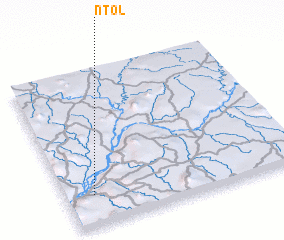 Places with similar names to Ntol, Cameroon ::
Disclaimer :: Information on this page comes without warranty of any kind |
||
|
Where is Ntol? Elevation and coordinates ::
Latitude (lat): 4°12'0"N Longitude (lon): 11°7'0"E
Elevation (approx.): 351m (map arrows pan, magnifying glasses zoom) |
||
|
Visiting Ntol? Hotel/Accommodation ::
Book a hotel in Ntol Travel Guide ::
Buy a travel guide for Cameroon rental cars ::
car rental offers GPS waypoint ::
download a GPX waypoint (PoI) of Ntol for your GPS receiver
|
||