|
search place name
|
||
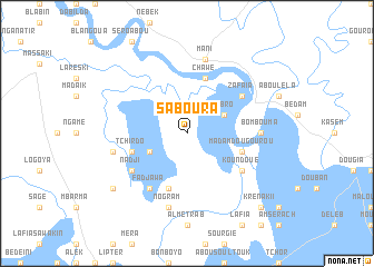
Saboura (Cameroon)Saboura is a town in Cameroon. An overview map of the region around Saboura is displayed below.
regional and 3d topo map of Saboura, Cameroon ::
Saboura airports ::
The nearest airport is NDJ - N'djamena Ndjamena Hassan Djamous, located 71.2 km south east of Saboura.
Other airports nearby include MIU - Maiduguri (194.5 km south west), Nearby towns ::
Kobro (4.1km north east) //
Béder (4.1km south west) //
Chawé (5.8km north) //
Madam Dougourou (5.7km east) //
Oumar Abied (5.8km south) //
Tchirdo (5.7km west) //
Zafaia (6.6km north east) //
Koundoué (6.6km south east) //
Fadjawa (6.6km south west) //
Nadji (6.6km south west) //
Bombouma (7.2km east) //
Ambasatna (7.2km east) //
Mani (7.6km north) //
Nogram (7.6km south) //
Oueilonaga (7.5km west) //
El Goumeri (9.1km south west) //
Krénak II (10.4km south east) //
[all distances 'as the bird flies' and approximate] 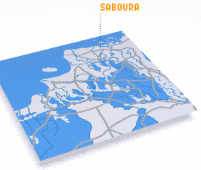 Places with similar names to Saboura, Cameroon ::
Disclaimer :: Information on this page comes without warranty of any kind |
||
|
Where is Saboura? Elevation and coordinates ::
Latitude (lat): 12°40'0"N Longitude (lon): 14°40'0"E
Elevation (approx.): 289m (map arrows pan, magnifying glasses zoom) |
||
|
Visiting Saboura? Hotel/Accommodation ::
Book a hotel in Saboura Travel Guide ::
Buy a travel guide for Cameroon rental cars ::
car rental offers GPS waypoint ::
download a GPX waypoint (PoI) of Saboura for your GPS receiver
|
||