|
search place name
|
||
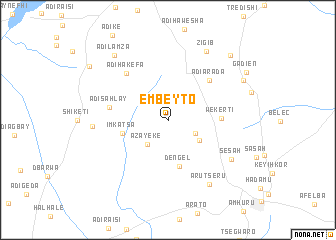
Embeyto (Eritrea)Embeyto is a town in Eritrea. An overview map of the region around Embeyto is displayed below.
regional and 3d topo map of Embeyto, Eritrea ::
Embeyto airports ::
The nearest airport is AXU - Axum, located 112.9 km south of Embeyto.
Other airports nearby include MQX - Makale (196.5 km south), Nearby towns ::
Ādī Āhiderom (3.2km south east) //
Āzayeke (3.5km south west) //
Damba (4.0km south east) //
Dengel (5.3km south) //
Imkʼatsʼa (5.1km west) //
Wekertī (5.7km east) //
Ādī Ār‘ada (6.3km north east) //
Ādī Sahlay (6.5km west) //
Ādī Hakefa (6.9km north west) //
Sesah (8.0km south east) //
Ār‘utsʼeru (8.3km south east) //
Ādī Kubulo (8.2km west) //
Zigib (8.7km north east) //
Āla (9.2km north east) //
Ādī Lamza (9.3km north west) //
Demba Carmet (9.9km north east) //
Gadien (10.0km north east) //
Selaʼi Daʼiro (10.3km north west) //
[all distances 'as the bird flies' and approximate] 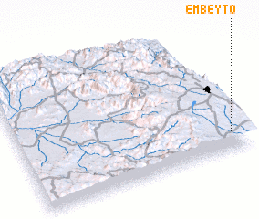 Places with similar names to Embeyto, Eritrea ::
Disclaimer :: Information on this page comes without warranty of any kind |
||
|
Where is Embeyto? Elevation and coordinates ::
Latitude (lat): 15°9'5"N Longitude (lon): 38°57'16"E
Elevation (approx.): 2176m (map arrows pan, magnifying glasses zoom) |
||
|
Visiting Embeyto? Hotel/Accommodation ::
Book a hotel in Embeyto Travel Guide ::
Buy a travel guide for Eritrea rental cars ::
car rental offers GPS waypoint ::
download a GPX waypoint (PoI) of Embeyto for your GPS receiver
|
||