|
search place name
|
||
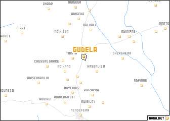
Gudela (Eritrea)Gudela is a town in Eritrea. An overview map of the region around Gudela is displayed below.
regional and 3d topo map of Gudela, Eritrea ::
Gudela airports ::
The nearest airport is AXU - Axum, located 94.0 km south of Gudela.
Other airports nearby include MQX - Makale (185.5 km south east), Nearby towns ::
Tera-Emnī (1.8km north) //
Takīta (2.7km west) //
Haserlibo (3.4km south east) //
Sheka Wedī Bisrat (4.0km south west) //
Ādī Shum Haftī (4.7km west) //
Ādī Kʼano (4.9km south west) //
Gina Bala (5.1km south) //
Ādī Godaʼitī (5.6km south west) //
Halhale (6.9km north) //
Ādī Hizba (7.1km north west) //
May Libus (7.7km south) //
Ādī Zarna (7.9km south) //
Gherghera (8.1km east) //
Chessad Dahrē (8.2km west) //
Emnī-Tselīm (8.8km north) //
Ādī Raʼisī (9.2km north east) //
[all distances 'as the bird flies' and approximate] 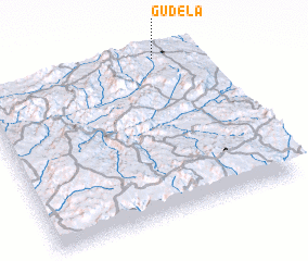 Places with similar names to Gudela, Eritrea ::
Disclaimer :: Information on this page comes without warranty of any kind |
||
|
Where is Gudela? Elevation and coordinates ::
Latitude (lat): 14°59'42"N Longitude (lon): 38°49'30"E
Elevation (approx.): 1918m (map arrows pan, magnifying glasses zoom) |
||
|
Visiting Gudela? Hotel/Accommodation ::
Book a hotel in Gudela Travel Guide ::
Buy a travel guide for Eritrea rental cars ::
car rental offers GPS waypoint ::
download a GPX waypoint (PoI) of Gudela for your GPS receiver
|
||