|
search place name
|
||
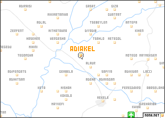
Ādī Ākel (Ethiopia)Ādī Ākel is a town in Ethiopia. An overview map of the region around Ādī Ākel is displayed below.
regional and 3d topo map of Ādī Ākel, Ethiopia ::
Ādī Ākel airports ::
The nearest airport is MQX - Makale, located 16.8 km south east of Ādī Ākel.
Other airports nearby include AXU - Axum (94.8 km north west), LLI - Lalibella (184.6 km south), GDQ - Gondar (246.7 km south west), Nearby towns ::
Alaur (2.6km south east) //
Mesihil (2.6km north west) //
Gembēla (5.2km south west) //
Dehan (5.2km south east) //
Tsʼahlo (5.2km north east) //
Ādeha (5.8km south) //
Dīyadib (5.8km north) //
Safīya (6.6km south east) //
Wergesha (6.6km north west) //
Ādī Misgan (7.8km south east) //
Mitʼmatʼ Āwra (7.8km north west) //
Misham (8.2km south west) //
Tsʼebeylen (8.2km north east) //
Metegol (8.1km north east) //
Hawho (9.2km south west) //
Gembēla (9.1km south east) //
[all distances 'as the bird flies' and approximate] 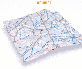 Places with similar names to Ādī Ākel, Ethiopia ::
Disclaimer :: Information on this page comes without warranty of any kind |
||
|
Where is Ādī Ākel? Elevation and coordinates ::
Latitude (lat): 13°35'0"N Longitude (lon): 39°26'0"E
Elevation (approx.): 1943m (map arrows pan, magnifying glasses zoom) |
||
|
Visiting Ādī Ākel? Hotel/Accommodation ::
Book a hotel in Ādī Ākel Travel Guide ::
Buy a travel guide for Ethiopia rental cars ::
car rental offers GPS waypoint ::
download a GPX waypoint (PoI) of Ādī Ākel for your GPS receiver
|
||