|
search place name
|
||
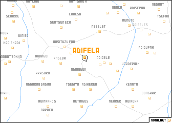
Ādī Fēla (Ethiopia)Ādī Fēla is a town in Ethiopia. An overview map of the region around Ādī Fēla is displayed below.
regional and 3d topo map of Ādī Fēla, Ethiopia ::
Ādī Fēla airports ::
The nearest airport is AXU - Axum, located 52.0 km west of Ādī Fēla.
Other airports nearby include MQX - Makale (70.6 km south east), GDQ - Gondar (258.0 km south west), Nearby towns ::
Ādī Hurug (3.0km east) //
Ādī Hēdum (3.1km south west) //
Ādī Hale (3.7km north west) //
Ādī Gele (3.8km east) //
Ādī Belew (5.2km east) //
Āngeba (5.4km west) //
Amsitu Zufan (5.5km north west) //
Meschel Tzedia (5.5km north west) //
Ādī Herem (6.2km south) //
Tsʼedīya (6.7km south west) //
Nebelet (7.1km north east) //
Tewleh (7.0km east) //
Sentsʼerech (9.1km north west) //
[all distances 'as the bird flies' and approximate] 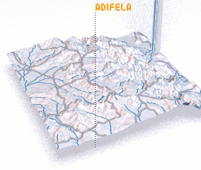 Places with similar names to Ādī Fēla, Ethiopia ::
// Adville (US)
// Adaval (PT)
// Atavola (MG)
// Aţ Ţafīlah (JO)
// Adafila (NG)
// Attavillu (LK)
// Adi-Ghelaʼe (ER)
// Aït Ighil (MA)
// Aït Oufella (MA)
// Ādī Fēla (ET)
Disclaimer :: Information on this page comes without warranty of any kind |
||
|
Where is Ādī Fēla? Elevation and coordinates ::
Latitude (lat): 14°2'17"N Longitude (lon): 39°14'30"E
Elevation (approx.): 1841m (map arrows pan, magnifying glasses zoom) |
||
|
Visiting Ādī Fēla? Hotel/Accommodation ::
Book a hotel in Ādī Fēla Travel Guide ::
Buy a travel guide for Ethiopia rental cars ::
car rental offers GPS waypoint ::
download a GPX waypoint (PoI) of Ādī Fēla for your GPS receiver
|
||