|
search place name
|
||
Ādīs Āmba (Ethiopia)Ādīs Āmba is a town in Ethiopia. An overview map of the region around Ādīs Āmba is displayed below.
regional and 3d topo map of Ādīs Āmba, Ethiopia ::

Ādīs Āmba airports ::
The nearest airport is ADD - Addis Ababa Bole Intl, located 92.9 km south of Ādīs Āmba.
Other airports nearby include BJR - Bahar Dar Bahir Dar (252.3 km north west), Nearby towns ::
Āngorchʼa (2.6km north east) //
Sekʼe Solē (2.6km north east) //
Fichē (2.6km south west) //
Muke Gema (2.6km south east) //
Gara (3.7km south) //
Ādīsgē (4.1km north east) //
Wedēs (4.1km south east) //
Kumando (4.1km south west) //
Kotīcho (4.1km south east) //
Ārīro (5.2km south west) //
Feres Āmba (5.2km south east) //
Kʼemetʼē (5.2km south west) //
Kʼerē (5.2km south east) //
Āleta (5.6km south) //
Guda (5.6km south) //
Botorī (5.8km west) //
Torban Āshē (5.8km west) //
Melahē (5.9km north) //
Geme Shokē (5.9km south) //
Chʼefē (6.7km south east) //
Bowa (6.7km south west) //
Serītī (6.6km south east) //
Dirē (6.6km south west) //
Bosē (7.4km south) //
Ādlochī (7.4km south) //
Doyu (7.4km south) //
Felasē (7.4km south) //
Kʼurkʼura (7.6km north) //
Hudad (7.6km north) //
[all distances 'as the bird flies' and approximate] 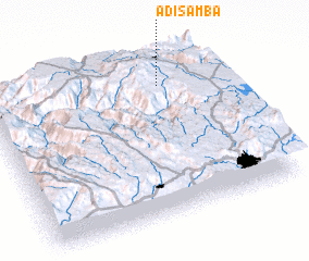 Places with similar names to Ādīs Āmba, Ethiopia ::
Disclaimer :: Information on this page comes without warranty of any kind |
||
|
Where is Ādīs Āmba? Elevation and coordinates ::
Latitude (lat): 9°49'0"N Longitude (lon): 38°45'0"E
Elevation (approx.): 2600m (map arrows pan, magnifying glasses zoom) |
||
|
Visiting Ādīs Āmba? Hotel/Accommodation ::
Book a hotel in Ādīs Āmba Travel Guide ::
Buy a travel guide for Ethiopia rental cars ::
car rental offers GPS waypoint ::
download a GPX waypoint (PoI) of Ādīs Āmba for your GPS receiver
|
||