|
search place name
|
||
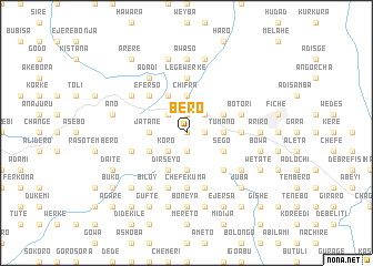
Bēro (Ethiopia)Bēro is a town in Ethiopia. An overview map of the region around Bēro is displayed below.
regional and 3d topo map of Bēro, Ethiopia ::
Bēro airports ::
The nearest airport is ADD - Addis Ababa Bole Intl, located 90.6 km south of Bēro.
Other airports nearby include BJR - Bahar Dar Bahir Dar (248.7 km north west), Nearby towns ::
Fago (0.0km north) //
Kara Gada (1.9km south) //
Galeyī (1.9km north) //
Gulelē (1.8km east) //
Kʼoro (2.6km south west) //
Temsa (2.6km north west) //
Mutʼēya (2.6km north east) //
Jatanē (3.7km west) //
Dībdībē (3.7km south) //
Tʼumano (3.7km east) //
Jīla (3.7km east) //
Jileyī (3.7km north) //
Chʼifra (3.7km north) //
Roso (4.1km south west) //
Sego (4.1km south east) //
Dīrseyo (4.1km south west) //
Gishē (4.1km north east) //
Degem Hambīso (4.1km north west) //
Keteba Dīlbo (5.2km south east) //
Ēfērso (5.2km north west) //
Lege Werkʼē (5.6km north) //
Chʼefēkʼuma (5.6km south) //
Dirē (5.5km east) //
Raso Gītīyē (5.8km west) //
Dirē (5.9km south) //
Gīno (5.9km south) //
Kora (5.9km south) //
Botorī (5.8km east) //
Torban Āshē (5.8km east) //
[all distances 'as the bird flies' and approximate] 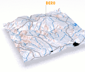 Places with similar names to Bēro, Ethiopia ::
Disclaimer :: Information on this page comes without warranty of any kind |
||
|
Where is Bēro? Elevation and coordinates ::
Latitude (lat): 9°47'0"N Longitude (lon): 38°39'0"E
Elevation (approx.): 3217m (map arrows pan, magnifying glasses zoom) |
||
|
Visiting Bēro? Hotel/Accommodation ::
Book a hotel in Bēro Travel Guide ::
Buy a travel guide for Ethiopia rental cars ::
car rental offers GPS waypoint ::
download a GPX waypoint (PoI) of Bēro for your GPS receiver
|
||