|
search place name
|
||
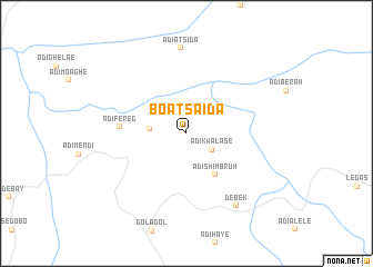
Boʼa Tsʼaʼida (Ethiopia)Boʼa Tsʼaʼida is a town in Ethiopia. An overview map of the region around Boʼa Tsʼaʼida is displayed below.
regional and 3d topo map of Boʼa Tsʼaʼida, Ethiopia ::
Boʼa Tsʼaʼida airports ::
The nearest airport is AXU - Axum, located 34.5 km south east of Boʼa Tsʼaʼida.
Other airports nearby include MQX - Makale (145.6 km south east), GDQ - Gondar (241.0 km south west), Nearby towns ::
Ādī Kʼwalasē (3.0km south east) //
Meda Kʼimtsʼay (3.6km west) //
Ādī Shimbruh (5.0km south east) //
Ādī Fereg (6.5km west) //
Adi-Atsida (8.6km north) //
Debekʼ (8.7km south east) //
[all distances 'as the bird flies' and approximate]  Places with similar names to Boʼa Tsʼaʼida, Ethiopia ::
// Bautista (PH)
// Bautista (PH)
// Bautista (PH)
// Bautista (PH)
// Bautista (PH)
// Butte City (US)
// Butte City (US)
// Båtstø (NO)
// Biedźiadów (PL)
// Batista (CU)
Disclaimer :: Information on this page comes without warranty of any kind |
||
|
Where is Boʼa Tsʼaʼida? Elevation and coordinates ::
Latitude (lat): 14°23'26"N Longitude (lon): 38°34'25"E
Elevation (approx.): 1632m (map arrows pan, magnifying glasses zoom) |
||
|
Visiting Boʼa Tsʼaʼida? Hotel/Accommodation ::
Book a hotel in Boʼa Tsʼaʼida Travel Guide ::
Buy a travel guide for Ethiopia rental cars ::
car rental offers GPS waypoint ::
download a GPX waypoint (PoI) of Boʼa Tsʼaʼida for your GPS receiver
|
||