|
search place name
|
||
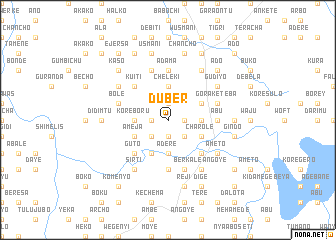
Duber (Ethiopia)Duber is a town in Ethiopia. An overview map of the region around Duber is displayed below.
regional and 3d topo map of Duber, Ethiopia ::
Duber airports ::
The nearest airport is ADD - Addis Ababa Bole Intl, located 56.0 km south of Duber.
Nearby towns ::
Ufkʼera (1.8km west) //
Gara Ādurē (1.9km south) //
Tulu Kurfa (1.8km west) //
Fogelē (1.9km north) //
Debelīcha (1.8km east) //
Wegīdī (2.6km south west) //
Tulu Korma (2.6km south west) //
Kereyu (2.6km south east) //
Āderē (3.7km south) //
Jatē (3.7km south) //
Kʼorē Boru (3.7km west) //
Chʼelekʼī (3.7km north) //
Guracha (3.7km east) //
Nado (4.1km south west) //
Āmeja (4.1km south west) //
Tefkī (4.1km south east) //
Chʼarolē (4.1km south east) //
Malīma (4.1km north east) //
Guto (5.2km south west) //
Kʼuītī (5.2km north west) //
Hēbeno (5.2km south east) //
Ābu (5.5km east) //
Īlu (5.5km east) //
Ādama (5.6km north) //
Īlamu (5.6km south) //
Kʼerbada (5.6km north) //
Dirē (5.6km south) //
Dīko (5.9km north) //
Bolē (5.8km west) //
[all distances 'as the bird flies' and approximate] 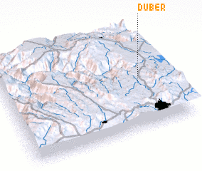 Places with similar names to Duber, Ethiopia ::
Disclaimer :: Information on this page comes without warranty of any kind |
||
|
Where is Duber? Elevation and coordinates ::
Latitude (lat): 9°29'0"N Longitude (lon): 38°50'0"E
Elevation (approx.): 2598m (map arrows pan, magnifying glasses zoom) |
||
|
Visiting Duber? Hotel/Accommodation ::
Book a hotel in Duber Travel Guide ::
Buy a travel guide for Ethiopia rental cars ::
car rental offers GPS waypoint ::
download a GPX waypoint (PoI) of Duber for your GPS receiver
|
||