|
search place name
|
||
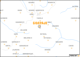
Gīderajo (Ethiopia)Gīderajo is a town in Ethiopia. An overview map of the region around Gīderajo is displayed below.
regional and 3d topo map of Gīderajo, Ethiopia ::
Gīderajo airports ::
The nearest airport is ADD - Addis Ababa Bole Intl, located 138.7 km south west of Gīderajo.
Nearby towns ::
Laygenet (1.9km north) //
Yigemlo (3.7km north) //
Āstakel (4.1km south east) //
Wanza Ber (4.1km north east) //
Kʼey Gedel (6.7km south east) //
Koso (6.7km north west) //
Kodebra (7.3km east) //
Debre Sīna (7.4km north) //
Welde Āb (7.5km west) //
Ābīlamoch (7.8km south west) //
Shola Mēda (8.3km north east) //
Dewaro (8.3km north west) //
[all distances 'as the bird flies' and approximate] 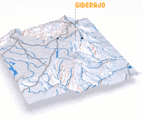
Disclaimer :: Information on this page comes without warranty of any kind |
||
|
Where is Gīderajo? Elevation and coordinates ::
Latitude (lat): 9°47'0"N Longitude (lon): 39°46'0"E
Elevation (approx.): 2493m (map arrows pan, magnifying glasses zoom) |
||
|
Visiting Gīderajo? Hotel/Accommodation ::
Book a hotel in Gīderajo Travel Guide ::
Buy a travel guide for Ethiopia rental cars ::
car rental offers GPS waypoint ::
download a GPX waypoint (PoI) of Gīderajo for your GPS receiver
|
||