|
search place name
|
||
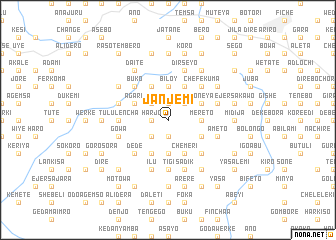
Janjemī (Ethiopia)Janjemī is a town in Ethiopia. An overview map of the region around Janjemī is displayed below.
regional and 3d topo map of Janjemī, Ethiopia ::
Janjemī airports ::
The nearest airport is ADD - Addis Ababa Bole Intl, located 82.3 km south of Janjemī.
Other airports nearby include BJR - Bahar Dar Bahir Dar (254.2 km north west), Nearby towns ::
Guftē (1.9km north) //
Lega (1.9km south) //
Raso (1.9km south) //
Hārjo (1.8km west) //
Dīde Kʼīlē (1.8km west) //
Kʼero (2.6km north east) //
Welēnso (2.6km south west) //
Āshoba (2.6km south west) //
Ārgītī (2.6km north west) //
Mereto (3.7km east) //
Gololē (3.7km east) //
Yaya (3.7km south) //
Bīloy (3.7km north) //
Kambo (4.1km south east) //
Giranchʼ (4.1km south east) //
Chʼemerī (4.1km south east) //
Kora (4.1km north east) //
Dirē (4.1km north east) //
Boneya (4.1km north east) //
Ādereka (4.1km north east) //
Berī (4.1km north east) //
Kʼechʼema (4.1km south east) //
Selalē (4.1km south east) //
Jelīsa (4.1km south west) //
Hurbu (4.1km north west) //
Āgarē (4.1km north west) //
Dīda Guba (5.2km south east) //
Sadīnī (5.2km south east) //
Chʼefēkʼuma (5.2km north east) //
[all distances 'as the bird flies' and approximate] 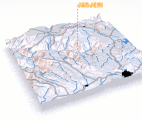 Places with similar names to Janjemī, Ethiopia ::
Disclaimer :: Information on this page comes without warranty of any kind |
||
|
Where is Janjemī? Elevation and coordinates ::
Latitude (lat): 9°42'0"N Longitude (lon): 38°37'0"E
Elevation (approx.): 2996m (map arrows pan, magnifying glasses zoom) |
||
|
Visiting Janjemī? Hotel/Accommodation ::
Book a hotel in Janjemī Travel Guide ::
Buy a travel guide for Ethiopia rental cars ::
car rental offers GPS waypoint ::
download a GPX waypoint (PoI) of Janjemī for your GPS receiver
|
||