|
search place name
|
||
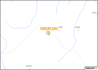
Nagacumi (Ethiopia)Nagacumi is a town in Ethiopia. An overview map of the region around Nagacumi is displayed below.
regional and 3d topo map of Nagacumi, Ethiopia ::
Nagacumi airports ::
The nearest airport is DIR - Dire Dawa Intl, located 111.8 km south east of Nagacumi.
Nearby towns ::
Corridra (4.1km north east) //
[all distances 'as the bird flies' and approximate]  Places with similar names to Nagacumi, Ethiopia ::
// Ngoakomba (CM)
// Ngakoma (CG)
// Nakikoma (UG)
// Nguigmi (NE)
// Ngogom (SN)
// Ncoacom (GQ)
// Nagokimbi (PG)
// Ngougoumou (CM)
// Ngougoumou (CM)
// Nkoakom (CM)
Disclaimer :: Information on this page comes without warranty of any kind |
||
|
Where is Nagacumi? Elevation and coordinates ::
Latitude (lat): 10°29'0"N Longitude (lon): 41°19'0"E
Elevation (approx.): 786m (map arrows pan, magnifying glasses zoom) |
||
|
Visiting Nagacumi? Hotel/Accommodation ::
Book a hotel in Nagacumi Travel Guide ::
Buy a travel guide for Ethiopia rental cars ::
car rental offers GPS waypoint ::
download a GPX waypoint (PoI) of Nagacumi for your GPS receiver
|
||