|
search place name
|
||
Tʼīs Isat (Ethiopia)Tʼīs Isat is a town in Ethiopia. An overview map of the region around Tʼīs Isat is displayed below.
regional and 3d topo map of Tʼīs Isat, Ethiopia ::

Tʼīs Isat airports ::
The nearest airport is BJR - Bahar Dar Bahir Dar, located 31.7 km north west of Tʼīs Isat.
Other airports nearby include GDQ - Gondar (115.8 km north), LLI - Lalibella (161.7 km east), MQX - Makale (305.1 km north east), Nearby towns ::
Welde Menta (4.1km south east) //
Koreta (5.4km west) //
Yegint (5.8km south) //
Shame Maryam (8.3km north east) //
Nifasha (9.2km south east) //
[all distances 'as the bird flies' and approximate] 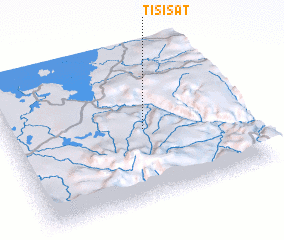 Places with similar names to Tʼīs Isat, Ethiopia ::
// Daisey City (US)
// Deseşti (RO)
// Dezeşti (RO)
// Doiceşti (RO)
// Dozeşti (RO)
// Duşeşti (RO)
// Duşeşti (RO)
// Tiseşti (RO)
// Deh Sīzdah (IR)
// Tassessat (NE)
Disclaimer :: Information on this page comes without warranty of any kind |
||
|
Where is Tʼīs Isat? Elevation and coordinates ::
Latitude (lat): 11°29'0"N Longitude (lon): 37°35'0"E
Elevation (approx.): 1643m (map arrows pan, magnifying glasses zoom) |
||
|
Visiting Tʼīs Isat? Hotel/Accommodation ::
Book a hotel in Tʼīs Isat Travel Guide ::
Buy a travel guide for Ethiopia rental cars ::
car rental offers GPS waypoint ::
download a GPX waypoint (PoI) of Tʼīs Isat for your GPS receiver
|
||