|
search place name
|
||
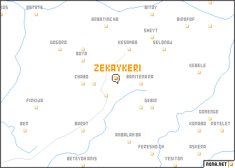
Zekʼaykʼerī (Ethiopia)Zekʼaykʼerī is a town in Ethiopia. An overview map of the region around Zekʼaykʼerī is displayed below.
regional and 3d topo map of Zekʼaykʼerī, Ethiopia ::
Zekʼaykʼerī airports ::
The nearest airport is LLI - Lalibella, located 22.0 km north of Zekʼaykʼerī.
Other airports nearby include BJR - Bahar Dar Bahir Dar (187.6 km west), GDQ - Gondar (192.2 km north west), MQX - Makale (194.1 km north), Nearby towns ::
Sar Machʼjīya (2.6km south west) //
Batelē (3.6km west) //
Banī Terara (3.6km east) //
Mukʼe Chʼin (5.2km south east) //
Chʼabo (5.4km west) //
Kes Āmba (5.8km north) //
Debir (6.6km south east) //
Boya (6.6km north west) //
Gubaʼē Mengerīya (7.8km north west) //
Barat (9.2km south west) //
Sheyt (9.2km north east) //
Selonaj (9.1km north east) //
[all distances 'as the bird flies' and approximate]  Places with similar names to Zekʼaykʼerī, Ethiopia ::
// Wysoka Góra (PL)
// Škegri (BA)
// Skógur (IS)
// Şeyhçakır (TR)
// Skugari (UA)
// Sego Kara (ET)
// Ségogourou (BJ)
// Sékougourou (BJ)
// Cigugur (ID)
// Cigugur (ID)
Disclaimer :: Information on this page comes without warranty of any kind |
||
|
Where is Zekʼaykʼerī? Elevation and coordinates ::
Latitude (lat): 11°47'0"N Longitude (lon): 39°2'0"E
Elevation (approx.): 3211m (map arrows pan, magnifying glasses zoom) |
||
|
Visiting Zekʼaykʼerī? Hotel/Accommodation ::
Book a hotel in Zekʼaykʼerī Travel Guide ::
Buy a travel guide for Ethiopia rental cars ::
car rental offers GPS waypoint ::
download a GPX waypoint (PoI) of Zekʼaykʼerī for your GPS receiver
|
||