|
search place name
|
||
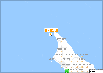
Arasji (Aruba)Arasji is a town in Aruba. An overview map of the region around Arasji is displayed below.
regional and 3d topo map of Arasji, Aruba ::
Arasji airports ::
The nearest airport is AUA - Oranjestad Reina Beatrix Intl, located 13.9 km south east of Arasji.
Other airports nearby include LSP - Paraguana Josefa Camejo (92.9 km south), CUR - Willemstad Hato (129.3 km east), CZE - Coro Jose Leonardo Chirinos (139.4 km south), BON - Kralendijk Flamingo (202.8 km east), Nearby towns ::
Westpunt (4.1km south east) //
Palm Beach (6.6km south east) //
Saliña Cerca (6.6km south east) //
Sint Anna (6.6km south east) //
Noord (7.8km south east) //
Bubali (8.2km south east) //
Cunucu Abao (8.2km south east) //
Gasparito (8.2km south east) //
Washington (8.2km south east) //
Shaba (9.2km south east) //
Sabana Liber (9.2km south east) //
Paraguaná (9.2km south east) //
Moco (10.4km south east) //
Soledad (10.4km south east) //
Calabas (10.4km south east) //
[all distances 'as the bird flies' and approximate] 
Disclaimer :: Information on this page comes without warranty of any kind |
||
|
Where is Arasji? Elevation and coordinates ::
Latitude (lat): 12°37'0"N Longitude (lon): 70°4'0"W
Elevation (approx.): -32768m (map arrows pan, magnifying glasses zoom) |
||
|
Visiting Arasji? Hotel/Accommodation ::
Book a hotel in Arasji Travel Guide ::
Buy a travel guide for Aruba rental cars ::
car rental offers GPS waypoint ::
download a GPX waypoint (PoI) of Arasji for your GPS receiver
|
||