|
search place name
|
||
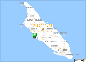
Piedra Plat (Aruba)Piedra Plat is a town in Aruba. An overview map of the region around Piedra Plat is displayed below.
regional and 3d topo map of Piedra Plat, Aruba ::
Piedra Plat airports ::
The nearest airport is AUA - Oranjestad Reina Beatrix Intl, located 3.9 km south west of Piedra Plat.
Other airports nearby include LSP - Paraguana Josefa Camejo (83.4 km south), CUR - Willemstad Hato (117.1 km east), CZE - Coro Jose Leonardo Chirinos (126.2 km south), BON - Kralendijk Flamingo (191.3 km east), Nearby towns ::
Cashero (0.0km north) //
Siribana (0.0km north) //
Pavía (0.0km north) //
Mon Pos (1.8km east) //
Shabiruri (1.8km east) //
Largo Cadushi (1.8km east) //
Casibari (1.9km north) //
Marawiel (1.9km north) //
Babijn (1.9km north) //
Mahuma (1.9km south) //
Santa Martha (1.9km south) //
Sabana Grandi (1.9km south) //
Canashito (1.9km south) //
Meiveld (1.8km west) //
San Barbola (1.8km west) //
Rooi Afó (1.8km west) //
Morgenster (1.8km west) //
Tamarijn (2.6km north east) //
Rooi Prikichi (2.6km north east) //
Macuarima (2.6km south east) //
Santa Cruz (2.6km south east) //
Shiribana (2.6km north west) //
Paradera (2.6km north west) //
Modansa (2.6km north west) //
Nuñe (2.6km north west) //
Wayaca (2.6km south west) //
Plantersrust (2.6km south west) //
Primavera (2.6km south west) //
Sabanía Abao (3.6km east) //
[all distances 'as the bird flies' and approximate] 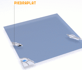 Places with similar names to Piedra Plat, Aruba :: Disclaimer :: Information on this page comes without warranty of any kind |
||
|
Where is Piedra Plat? Elevation and coordinates ::
Latitude (lat): 12°31'0"N Longitude (lon): 69°59'0"W
Elevation (approx.): 26m (map arrows pan, magnifying glasses zoom) |
||
|
Visiting Piedra Plat? Hotel/Accommodation ::
Book a hotel in Piedra Plat Travel Guide ::
Buy a travel guide for Aruba rental cars ::
car rental offers GPS waypoint ::
download a GPX waypoint (PoI) of Piedra Plat for your GPS receiver
|
||