|
search place name
|
||
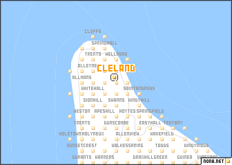
Cleland (Saint Andrew, Barbados)Cleland is a town in the Saint Andrew region of Barbados. An overview map of the region around Cleland is displayed below.
regional and 3d topo map of Cleland, Barbados ::
Cleland airports ::
The nearest airport is BGI - Bridgetown Grantley Adams Intl, located 23.4 km south east of Cleland.
Other airports nearby include UVF - Hewandorra Hewanorra Intl (157.0 km west), SLU - Castries George F L Charles (173.8 km north west), SVD - Kingstown E T Joshua (176.9 km west), MQS - Mustique (178.2 km west), Nearby towns ::
Welchtown (0.0km north) //
Moore Hill (0.0km north) //
Mount Stepney (0.0km north) //
Welch Town (0.0km north) //
Morgan Lewis (1.8km east) //
Collins (1.9km north) //
Graveyard (1.9km north) //
Ellis Castle (1.9km north) //
The Baltic (1.9km north) //
Gays (1.9km north) //
Saint Nicholas (1.9km north) //
Date Tree Hill (1.9km north) //
Breedyʼs (1.9km south) //
Prospect (1.9km south) //
Sedge Pond (1.9km south) //
Benny Hall (1.8km west) //
Mount Brevitor (1.8km west) //
Diamond Corner (1.8km west) //
Portland (1.8km west) //
Castle (1.8km west) //
Boscobelle (2.6km north east) //
The Risk (2.6km north east) //
Greenland (2.6km south east) //
Belleplaine (2.6km south east) //
Shorey (2.6km south east) //
Rock Hall (2.6km north west) //
Alexandra (2.6km north west) //
Cottage (2.6km north west) //
Oxford (2.6km north west) //
[all distances 'as the bird flies' and approximate]  Places with similar names to Cleland, Barbados ::
Disclaimer :: Information on this page comes without warranty of any kind |
||
|
Where is Cleland? Elevation and coordinates ::
Latitude (lat): 13°16'0"N Longitude (lon): 59°35'0"W
Elevation (approx.): 139m (map arrows pan, magnifying glasses zoom) |
||
|
Visiting Cleland? Hotel/Accommodation ::
Book a hotel in Cleland Travel Guide ::
Buy a travel guide for Barbados rental cars ::
car rental offers GPS waypoint ::
download a GPX waypoint (PoI) of Cleland for your GPS receiver
|
||