|
search place name
|
||
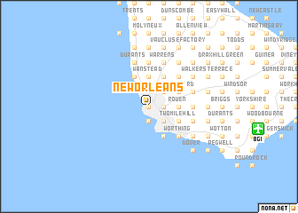
New Orleans (Saint Michael, Barbados)New Orleans is a town in the Saint Michael region of Barbados. An overview map of the region around New Orleans is displayed below.
regional and 3d topo map of New Orleans, Barbados ::
New Orleans airports ::
The nearest airport is BGI - Bridgetown Grantley Adams Intl, located 13.8 km east of New Orleans.
Other airports nearby include UVF - Hewandorra Hewanorra Intl (160.7 km north west), MQS - Mustique (171.2 km west), SVD - Kingstown E T Joshua (172.9 km west), SLU - Castries George F L Charles (180.4 km north west), Nearby towns ::
Brighton (0.0km north) //
Deacons (0.0km north) //
Bridgetown (0.0km north) //
Cheapside (1.9km south) //
Station Hill (1.8km east) //
Pine Housing Estate (1.8km east) //
Bank Hall (1.8km east) //
Fairfield (2.6km north east) //
Bayville (2.6km south east) //
Codrington (2.6km north east) //
Weymouth (2.6km south east) //
Rock Dundo (2.6km north east) //
Belmont (2.6km south east) //
Henrys (2.6km south east) //
Wanstead (3.7km north) //
Oxnards (3.7km north) //
Lazaretto (3.7km north) //
Cave Hill (3.7km north) //
Prior Park (3.7km north) //
Mount Friendship (3.6km east) //
Howells (3.6km east) //
Rouen (3.6km east) //
Black Rock (4.1km north west) //
Fitts (4.1km north west) //
Prospect (4.1km north west) //
Saint Mathias (4.1km south east) //
Rockley (4.1km south east) //
Garrison (4.1km south east) //
Friendship Terrace (4.1km north east) //
[all distances 'as the bird flies' and approximate] 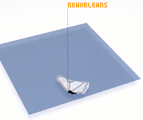 Places with similar names to New Orleans, Barbados ::
// New Orleans (US)
Disclaimer :: Information on this page comes without warranty of any kind |
||
|
Where is New Orleans? Elevation and coordinates ::
Latitude (lat): 13°6'0"N Longitude (lon): 59°37'0"W
Elevation (approx.): 10m (map arrows pan, magnifying glasses zoom) |
||
|
Visiting New Orleans? Hotel/Accommodation ::
Book a hotel in New Orleans Travel Guide ::
Buy a travel guide for Barbados rental cars ::
car rental offers GPS waypoint ::
download a GPX waypoint (PoI) of New Orleans for your GPS receiver
|
||