|
search place name
|
||
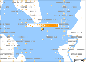
Phumĭ Ângkôr Borei (Takêv, Cambodia)Phumĭ Ângkôr Borei is a town in the Takêv region of Cambodia. An overview map of the region around Phumĭ Ângkôr Borei is displayed below.
regional and 3d topo map of Phumĭ Ângkôr Borei, Cambodia ::
Phumĭ Ângkôr Borei airports ::
The nearest airport is PNH - Phnom-penh Phnom Penh Intl, located 64.1 km north of Phumĭ Ângkôr Borei.
Other airports nearby include SGN - Ho Chi Minh City Tansonnhat Intl (183.3 km east), Nearby towns ::
Phumĭ Khnâng Koŭ (1.9km north) //
Phumĭ Pŏstĕ Chăs (1.8km east) //
Phumĭ Prêk Khtôr (2.6km south east) //
Phumĭ Phnum Ângkôr Borei (3.7km south) //
Phumĭ Stœ̆ng Sândêk (4.1km north east) //
Phumĭ Ta Trâk (5.2km north west) //
Phumĭ Prêk Da (5.2km south east) //
Phumĭ Tuŏl Săng (6.6km north west) //
Phumĭ Prey Phkŏâm (7.5km west) //
Phumĭ Kâmpóng Slêng (7.6km north) //
Phumĭ Kâmpóng Khsăch (7.6km north) //
Vôtt Ângk Chŭm (8.2km north west) //
Phumĭ Ta Ei (8.3km north west) //
Phumĭ Prey Phdau Krau (9.2km south west) //
Phumĭ Prey Phdau Knŏng (9.2km south west) //
Phumĭ Rôka (9.2km north west) //
[all distances 'as the bird flies' and approximate] 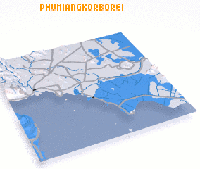 Places with similar names to Phumĭ Ângkôr Borei, Cambodia :: Disclaimer :: Information on this page comes without warranty of any kind |
||
|
Where is Phumĭ Ângkôr Borei? Elevation and coordinates ::
Latitude (lat): 10°59'0"N Longitude (lon): 104°59'0"E
Elevation (approx.): 7m (map arrows pan, magnifying glasses zoom) |
||
|
Visiting Phumĭ Ângkôr Borei? Hotel/Accommodation ::
Book a hotel in Phumĭ Ângkôr Borei Travel Guide ::
Buy a travel guide for Cambodia rental cars ::
car rental offers GPS waypoint ::
download a GPX waypoint (PoI) of Phumĭ Ângkôr Borei for your GPS receiver
|
||