|
search place name
|
||
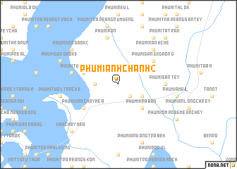
Phumĭ Ânhchanh (2) (Prey Vêng, Cambodia)Phumĭ Ânhchanh (2) is a town in the Prey Vêng region of Cambodia. An overview map of the region around Phumĭ Ânhchanh (2) is displayed below.
regional and 3d topo map of Phumĭ Ânhchanh (2), Cambodia ::
Phumĭ Ânhchanh (2) airports ::
The nearest airport is PNH - Phnom-penh Phnom Penh Intl, located 97.6 km west of Phumĭ Ânhchanh (2).
Other airports nearby include SGN - Ho Chi Minh City Tansonnhat Intl (136.1 km south east), REP - Siem-reap Siem Reap (285.5 km north west), Nearby towns ::
Phumĭ Ta Vóng (2.6km south east) //
Phumĭ Krâbau (2.6km south east) //
Phumĭ Trâpeăng Khna (1) (3.6km west) //
Phumĭ Kânlêng Chrŏu (4.1km south east) //
Phumĭ Krâbau (5.2km south east) //
Phumĭ Tuŏl Sângkê (1) (5.8km west) //
Phumĭ Tuŏl Sângkê (2) (5.8km west) //
Phumĭ Dâng Kdaông (6.6km north east) //
Phumĭ Kâmchay Méa (6.6km south west) //
Phumĭ Sântey (7.3km east) //
Phumĭ Trâpeăng Rôméas (7.5km west) //
Phumĭ Pôn (7.6km north) //
Phumĭ Kânhchê (7.8km north east) //
Phumĭ Dondaôk (2) (9.1km north west) //
Phumĭ Bŏs Té (9.2km north east) //
Kâmchay Méa (10.4km south west) //
Phumĭ Tatrav (10.4km north east) //
[all distances 'as the bird flies' and approximate] 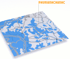 Places with similar names to Phumĭ Ânhchanh (2), Cambodia ::
Disclaimer :: Information on this page comes without warranty of any kind |
||
|
Where is Phumĭ Ânhchanh (2)? Elevation and coordinates ::
Latitude (lat): 11°39'0"N Longitude (lon): 105°44'0"E
Elevation (approx.): 10m (map arrows pan, magnifying glasses zoom) |
||
|
Visiting Phumĭ Ânhchanh (2)? Hotel/Accommodation ::
Book a hotel in Phumĭ Ânhchanh (2) Travel Guide ::
Buy a travel guide for Cambodia rental cars ::
car rental offers GPS waypoint ::
download a GPX waypoint (PoI) of Phumĭ Ânhchanh (2) for your GPS receiver
|
||