|
search place name
|
||
Phumĭ Ânlóng Svay (Stœ̆ng Trêng, Cambodia)Phumĭ Ânlóng Svay is a town in the Stœ̆ng Trêng region of Cambodia. An overview map of the region around Phumĭ Ânlóng Svay is displayed below.
regional and 3d topo map of Phumĭ Ânlóng Svay, Cambodia ::

Phumĭ Ânlóng Svay airports ::
The nearest airport is PKZ - Pakse, located 135.9 km north of Phumĭ Ânlóng Svay.
Nearby towns ::
Veun Kham (1.8km east) //
Ban Donsadam (1.9km north) //
Preăh Ângkoăl (1.9km south) //
Phumĭ Ânlóng Chheutéal (1.8km west) //
Ban Khon Tai (2.6km north west) //
Phumĭ Kaôh Nhang (3.6km east) //
Phumĭ Ânlóng Kreul (3.7km south) //
Phumĭ Kaôh Pnŏu (4.0km south east) //
Ban Khon (5.2km north west) //
Phumĭ Krâla Peăh (5.6km south) //
Ban Donsôm (6.6km north west) //
Ban Dondét (8.2km north west) //
Ban Donsôm Tai (9.2km north west) //
Ban Sôm (9.2km north west) //
Ban Donsang (10.3km north west) //
[all distances 'as the bird flies' and approximate] 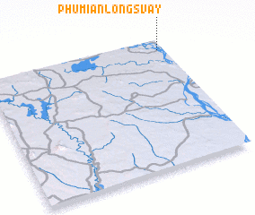 Places with similar names to Phumĭ Ânlóng Svay, Cambodia ::
// Phumĭ Anlóng Svay (KH)
// Phumĭ Ânlóng Svay (KH)
// Phumĭ Ânlóng Svay (KH)
// Phumĭ Ânlóng Svay (KH)
// Phumĭ Ânlóng Svay (KH)
// Phumĭ Ânlóng Svay (KH)
// Phumĭ Ânlóng Svay (KH)
Disclaimer :: Information on this page comes without warranty of any kind |
||
|
Where is Phumĭ Ânlóng Svay? Elevation and coordinates ::
Latitude (lat): 13°55'0"N Longitude (lon): 105°58'0"E
Elevation (approx.): 50m (map arrows pan, magnifying glasses zoom) |
||
|
Visiting Phumĭ Ânlóng Svay? Hotel/Accommodation ::
Book a hotel in Phumĭ Ânlóng Svay Travel Guide ::
Buy a travel guide for Cambodia rental cars ::
car rental offers GPS waypoint ::
download a GPX waypoint (PoI) of Phumĭ Ânlóng Svay for your GPS receiver
|
||