|
search place name
|
||
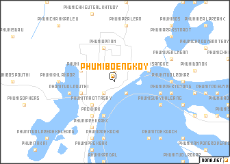
Phumĭ Bœ̆ng Koy (Kâmpóng Cham, Cambodia)Phumĭ Bœ̆ng Koy is a town in the Kâmpóng Cham region of Cambodia. An overview map of the region around Phumĭ Bœ̆ng Koy is displayed below.
regional and 3d topo map of Phumĭ Bœ̆ng Koy, Cambodia ::
Phumĭ Bœ̆ng Koy airports ::
The nearest airport is PNH - Phnom-penh Phnom Penh Intl, located 114.6 km south west of Phumĭ Bœ̆ng Koy.
Other airports nearby include SGN - Ho Chi Minh City Tansonnhat Intl (202.1 km south east), REP - Siem-reap Siem Reap (226.6 km north west), Nearby towns ::
Phumĭ O Châk (1.9km north) //
Phumĭ Kdŏl Leu (2.6km south east) //
Phumĭ Bœ̆ng Kachok (2.6km south west) //
Phumĭ Tnaôt Ta Say (5.2km south west) //
Phumĭ Méakh (5.7km west) //
Phumĭ O Prăm (5.7km west) //
Phumĭ Prêk Sângkê (5.7km east) //
Phumĭ O Prăm (5.8km north) //
Phumĭ Kdŏl Kraôm (5.8km south) //
Phumĭ Tréa (1) (5.8km south) //
Prêk Kák (6.6km south west) //
Phumĭ Daeum Chrey (7.5km east) //
Kroch Chhmar (7.5km east) //
Phumĭ Tuŏl Poŭthĭ (7.5km west) //
Phumĭ Svay Khleăng (8.1km south east) //
Phumĭ Prêk Kák (2) (8.3km south west) //
[all distances 'as the bird flies' and approximate]  Places with similar names to Phumĭ Bœ̆ng Koy, Cambodia ::
// Phumĭ Béng (2) (KH)
Disclaimer :: Information on this page comes without warranty of any kind |
||
|
Where is Phumĭ Bœ̆ng Koy? Elevation and coordinates ::
Latitude (lat): 12°18'0"N Longitude (lon): 105°34'0"E
Elevation (approx.): 85m (map arrows pan, magnifying glasses zoom) |
||
|
Visiting Phumĭ Bœ̆ng Koy? Hotel/Accommodation ::
Book a hotel in Phumĭ Bœ̆ng Koy Travel Guide ::
Buy a travel guide for Cambodia rental cars ::
car rental offers GPS waypoint ::
download a GPX waypoint (PoI) of Phumĭ Bœ̆ng Koy for your GPS receiver
|
||