|
search place name
|
||
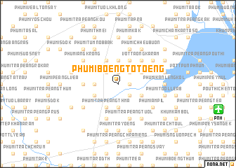
Phumĭ Bœ̆ng Tôtœ̆ng (Bântéay Méan Cheăy, Cambodia)Phumĭ Bœ̆ng Tôtœ̆ng is a town in the Bântéay Méan Cheăy region of Cambodia. An overview map of the region around Phumĭ Bœ̆ng Tôtœ̆ng is displayed below.
regional and 3d topo map of Phumĭ Bœ̆ng Tôtœ̆ng, Cambodia ::
Phumĭ Bœ̆ng Tôtœ̆ng airports ::
The nearest airport is PNH - Phnom-penh Phnom Penh Intl, located 16.2 km east of Phumĭ Bœ̆ng Tôtœ̆ng.
Other airports nearby include REP - Siem-reap Siem Reap (224.0 km north west), SGN - Ho Chi Minh City Tansonnhat Intl (229.3 km east), Nearby towns ::
Phumĭ Khlŏng (1.9km north) //
Phumĭ Bœ̆ng Ânhchanh (1.8km east) //
Phumĭ Bœ̆ng Rôméas (1.8km east) //
Phumĭ Phnum Dei (2.6km south east) //
Phumĭ Prey Phchœ̆k (2.6km south east) //
Phumĭ Khna (2.6km north east) //
Phumĭ Krăng Kroch (2.6km north west) //
Phumĭ Dâmnăk Kâkaôh (3.7km south) //
Phumĭ Vôtt Phnum (3.6km west) //
Phumĭ Châmkar Kroch (3.6km west) //
Phumĭ Koŭl (3.7km north) //
Phumĭ Ângk Slêng (4.1km south east) //
Phumĭ Roŭng Dâmrei (4.1km south west) //
Vôtt Chhuk Kán Dom (4.1km north east) //
Phumĭ Srê Omprŭm (4.1km south west) //
Phumĭ Trâpeăng Thmâ (4.1km south west) //
Phumĭ Ângk Tasĕt (2) (4.1km north west) //
Phumĭ Chhák Krâsăng (4.1km north east) //
Vôtt Aôngkaram (5.2km north east) //
Phumĭ Krâbei Prey (5.4km west) //
Phumĭ Trâpeăng Trach (5.8km south) //
Phumĭ Trâpeăng Tuŏl (5.8km south) //
Phumĭ Lumhach (5.8km north) //
Phumĭ Ângk Sduŏch (5.8km north) //
Phumĭ Trâpeăng Khla (6.6km south east) //
Phumĭ Krăng Léav (6.6km south west) //
Phumĭ Bœ̆ng Kreul (6.6km south east) //
Phumĭ Bœ̆ng Kâmbol (6.6km south east) //
Phumĭ Âmpĭl (6.6km south east) //
[all distances 'as the bird flies' and approximate]  Places with similar names to Phumĭ Bœ̆ng Tôtœ̆ng, Cambodia :: Disclaimer :: Information on this page comes without warranty of any kind |
||
|
Where is Phumĭ Bœ̆ng Tôtœ̆ng? Elevation and coordinates ::
Latitude (lat): 11°35'0"N Longitude (lon): 104°42'0"E
Elevation (approx.): 24m (map arrows pan, magnifying glasses zoom) |
||
|
Visiting Phumĭ Bœ̆ng Tôtœ̆ng? Hotel/Accommodation ::
Book a hotel in Phumĭ Bœ̆ng Tôtœ̆ng Travel Guide ::
Buy a travel guide for Cambodia rental cars ::
car rental offers GPS waypoint ::
download a GPX waypoint (PoI) of Phumĭ Bœ̆ng Tôtœ̆ng for your GPS receiver
|
||