|
search place name
|
||
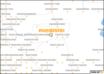
Phumĭ Bŏs Pôk (Kâmpóng Cham, Cambodia)Phumĭ Bŏs Pôk is a town in the Kâmpóng Cham region of Cambodia. An overview map of the region around Phumĭ Bŏs Pôk is displayed below.
regional and 3d topo map of Phumĭ Bŏs Pôk, Cambodia ::
Phumĭ Bŏs Pôk airports ::
The nearest airport is PNH - Phnom-penh Phnom Penh Intl, located 85.2 km south west of Phumĭ Bŏs Pôk.
Other airports nearby include REP - Siem-reap Siem Reap (209.6 km north west), SGN - Ho Chi Minh City Tansonnhat Intl (212.3 km south east), Nearby towns ::
Phumĭ Châmkar Kroch (1.8km east) //
Phumĭ Châmkar Svay (2.6km south west) //
Phumĭ Bŏs Kântuŏt (2.6km north west) //
Phumĭ Têt Chăs (3.6km east) //
Phumĭ Léan Lvé (4.1km south east) //
Phumĭ Svay Méas (4.1km north east) //
Phumĭ Ândong Chhăm Chha (1) (5.4km west) //
Phumĭ Bŏs Khnŏr (5.4km east) //
Phumĭ Ta Ŏng (5.8km north) //
Phumĭ O Khsê Trêng (6.6km south west) //
Phumĭ Thmâ Pun (6.6km south west) //
Phumĭ Ândong Chhăm Chha (2) (6.6km north west) //
Phumĭ O Ta Thŏk (7.5km west) //
Phumĭ Don Thi (9.2km south east) //
Phumĭ Takêv (10.4km south west) //
[all distances 'as the bird flies' and approximate]  Places with similar names to Phumĭ Bŏs Pôk, Cambodia ::
// Phumĭ Bŏs Pôk (KH)
Disclaimer :: Information on this page comes without warranty of any kind |
||
|
Where is Phumĭ Bŏs Pôk? Elevation and coordinates ::
Latitude (lat): 12°11'0"N Longitude (lon): 105°17'0"E
Elevation (approx.): 118m (map arrows pan, magnifying glasses zoom) |
||
|
Visiting Phumĭ Bŏs Pôk? Hotel/Accommodation ::
Book a hotel in Phumĭ Bŏs Pôk Travel Guide ::
Buy a travel guide for Cambodia rental cars ::
car rental offers GPS waypoint ::
download a GPX waypoint (PoI) of Phumĭ Bŏs Pôk for your GPS receiver
|
||