|
search place name
|
||
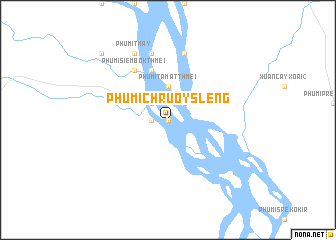
Phumĭ Chruŏy Slêng (Stœ̆ng Trêng, Cambodia)Phumĭ Chruŏy Slêng is a town in the Stœ̆ng Trêng region of Cambodia. An overview map of the region around Phumĭ Chruŏy Slêng is displayed below.
regional and 3d topo map of Phumĭ Chruŏy Slêng, Cambodia ::
Phumĭ Chruŏy Slêng airports ::
The nearest airport is PKZ - Pakse, located 210.9 km north of Phumĭ Chruŏy Slêng.
Other airports nearby include PNH - Phnom-penh Phnom Penh Intl (222.0 km south west), Nearby towns ::
Phumĭ Rônéam (0.0km north) //
Phumĭ Trei (1.8km west) //
Phumĭ Mi Thmei (2.6km north east) //
Phumĭ Lŭng Thmei (2.6km north west) //
Phumĭ Kaôh Préal (2.6km north west) //
Phumĭ Tamăt Thmei (3.7km north) //
Phumĭ Siĕmbok (5.8km north) //
Phumĭ Siĕmbok Thmei (6.6km north west) //
Kaôh Preăh (7.6km north) //
Phumĭ Kaôh Preăh Thmei (7.6km north) //
Phumĭ Tmay (8.2km north west) //
Phumĭ Salŏng (10.3km north west) //
[all distances 'as the bird flies' and approximate]  Places with similar names to Phumĭ Chruŏy Slêng, Cambodia ::
// Phumĭ Chruŏy Slêng (KH)
Disclaimer :: Information on this page comes without warranty of any kind |
||
|
Where is Phumĭ Chruŏy Slêng? Elevation and coordinates ::
Latitude (lat): 13°14'0"N Longitude (lon): 105°57'0"E
Elevation (approx.): 37m (map arrows pan, magnifying glasses zoom) |
||
|
Visiting Phumĭ Chruŏy Slêng? Hotel/Accommodation ::
Book a hotel in Phumĭ Chruŏy Slêng Travel Guide ::
Buy a travel guide for Cambodia rental cars ::
car rental offers GPS waypoint ::
download a GPX waypoint (PoI) of Phumĭ Chruŏy Slêng for your GPS receiver
|
||