|
search place name
|
||
Phumĭ Dong (Kâmpóng Thum, Cambodia)Phumĭ Dong is a town in the Kâmpóng Thum region of Cambodia. An overview map of the region around Phumĭ Dong is displayed below.
regional and 3d topo map of Phumĭ Dong, Cambodia ::

Phumĭ Dong airports ::
The nearest airport is PNH - Phnom-penh Phnom Penh Intl, located 107.8 km south of Phumĭ Dong.
Other airports nearby include REP - Siem-reap Siem Reap (174.8 km north west), SGN - Ho Chi Minh City Tansonnhat Intl (248.8 km south east), Nearby towns ::
Phumĭ Tuŏl Sala (1.9km south) //
Phumĭ Kâmpaeuy (1.8km east) //
Phumĭ Kâmpóng Thmâ (1.8km east) //
Phumĭ Khley (2.6km north east) //
Phumĭ Barayn Choăn Dêk (2.6km north east) //
Phumĭ Tuŏl Dâmnăk (3.7km south) //
Phumĭ Pôpéch (3.7km south) //
Phumĭ Prey Phlu (3.7km north) //
Phumĭ Khsăch L'ĕt (4.1km south west) //
Phumĭ Loŭk (4.1km south west) //
Phumĭ Bântéay Méas (4.1km north west) //
Phumĭ Trâpeăng Khnák (1) (4.1km north west) //
Phumĭ Prey Srâkar (5.4km west) //
Phumĭ Bœ̆ng (1) (5.6km south) //
Phumĭ Balăngk Tuŏl (5.7km east) //
Phumĭ Trâpeăng Chhuk (5.8km south) //
Phumĭ Trâpeăng Khnák (2) (5.8km north) //
Phumĭ Bêk Chiĕm (6.6km north east) //
Phumĭ Tuŏl Lvéang (6.6km south west) //
Phumĭ Snaô (6.6km north east) //
Phumĭ Prey Dom (7.2km east) //
Phumĭ Tnaôt Chŭm (7.8km north west) //
Phumĭ Sâmraông (1) (8.2km south west) //
Phumĭ Prâsat (1) (8.2km north west) //
Phumĭ L'ák (9.2km north east) //
Phumĭ Srâlau Tong (10.4km south east) //
[all distances 'as the bird flies' and approximate] 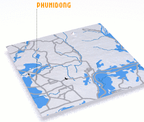 Places with similar names to Phumĭ Dong, Cambodia ::
// Phum Dong (KH)
// Phumĭ Dong (KH)
// Phumĭ Dong (KH)
// Phumĭ Dong (KH)
// Phumĭ Dong (KH)
// Phumĭ Dong (KH)
// Phumĭ Dong (KH)
// Phumĭ Dong (KH)
// Phumĭ Dong (KH)
// Phumĭ Dong (KH)
Disclaimer :: Information on this page comes without warranty of any kind |
||
|
Where is Phumĭ Dong? Elevation and coordinates ::
Latitude (lat): 12°29'0"N Longitude (lon): 105°7'0"E
Elevation (approx.): 15m (map arrows pan, magnifying glasses zoom) |
||
|
Visiting Phumĭ Dong? Hotel/Accommodation ::
Book a hotel in Phumĭ Dong Travel Guide ::
Buy a travel guide for Cambodia rental cars ::
car rental offers GPS waypoint ::
download a GPX waypoint (PoI) of Phumĭ Dong for your GPS receiver
|
||