|
search place name
|
||
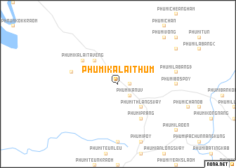
Phumĭ Kalai Thum (Rôtânăh Kiri, Cambodia)Phumĭ Kalai Thum is a town in the Rôtânăh Kiri region of Cambodia. An overview map of the region around Phumĭ Kalai Thum is displayed below.
regional and 3d topo map of Phumĭ Kalai Thum, Cambodia ::
Phumĭ Kalai Thum airports ::
The nearest airport is PKZ - Pakse, located 191.1 km north west of Phumĭ Kalai Thum.
Nearby towns ::
Phumĭ Kala (1.8km east) //
Phumĭ Kanuv (2.6km south east) //
Phumĭ Thlâng Svay (5.2km south east) //
Phumĭ Kalai Kala (5.2km north west) //
Phumĭ Prang (6.6km south east) //
Phumĭ Kalai Tavêng (6.5km north west) //
Phumĭ Kalai Kanuv (7.4km west) //
Phumĭ Vóng (10.3km north east) //
[all distances 'as the bird flies' and approximate]  Places with similar names to Phumĭ Kalai Thum, Cambodia ::
// Phumĭ Koŭl Thmei (KH)
Disclaimer :: Information on this page comes without warranty of any kind |
||
|
Where is Phumĭ Kalai Thum? Elevation and coordinates ::
Latitude (lat): 13°50'0"N Longitude (lon): 106°57'0"E
Elevation (approx.): 232m (map arrows pan, magnifying glasses zoom) |
||
|
Visiting Phumĭ Kalai Thum? Hotel/Accommodation ::
Book a hotel in Phumĭ Kalai Thum Travel Guide ::
Buy a travel guide for Cambodia rental cars ::
car rental offers GPS waypoint ::
download a GPX waypoint (PoI) of Phumĭ Kalai Thum for your GPS receiver
|
||