|
search place name
|
||
Phumĭ Kâmpóng Khlŏng (Kâmpóng Thum, Cambodia)Phumĭ Kâmpóng Khlŏng is a town in the Kâmpóng Thum region of Cambodia. An overview map of the region around Phumĭ Kâmpóng Khlŏng is displayed below.
regional and 3d topo map of Phumĭ Kâmpóng Khlŏng, Cambodia ::

Phumĭ Kâmpóng Khlŏng airports ::
The nearest airport is REP - Siem-reap Siem Reap, located 86.2 km north west of Phumĭ Kâmpóng Khlŏng.
Other airports nearby include PNH - Phnom-penh Phnom Penh Intl (162.4 km south), Nearby towns ::
Phumĭ Prâkéab (0.0km north) //
Phumĭ Bœ̆ng Sântung (1.8km west) //
Phumĭ Ta Sâr (2.6km south east) //
Phumĭ Khvan (4.1km south west) //
Phumĭ Kâmpóng Prâchŭm (6.6km south east) //
Phumĭ Bát Tráng (6.6km south east) //
Phumĭ Néang Sâr Sngach (1) (7.5km east) //
Phumĭ Néang Sâr Sngach (2) (7.5km east) //
Phumĭ Lvéay (7.6km north) //
Phumĭ Koŭk Tréa (8.1km south east) //
Phumĭ Msa Krâng (8.1km south east) //
Phumĭ Sâmbuŏr (8.1km south east) //
Phumĭ Kâmphléanh (8.2km south west) //
Phumĭ Krêng (9.1km north east) //
Ângk Khleăng (9.2km north east) //
Phumĭ Koŭk Rôviĕng (9.2km north east) //
Phumĭ Kâmpóng Veăng (9.2km north east) //
[all distances 'as the bird flies' and approximate] 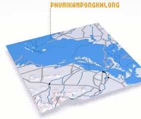 Places with similar names to Phumĭ Kâmpóng Khlŏng, Cambodia :: Disclaimer :: Information on this page comes without warranty of any kind |
||
|
Where is Phumĭ Kâmpóng Khlŏng? Elevation and coordinates ::
Latitude (lat): 12°58'0"N Longitude (lon): 104°28'0"E
Elevation (approx.): 11m (map arrows pan, magnifying glasses zoom) |
||
|
Visiting Phumĭ Kâmpóng Khlŏng? Hotel/Accommodation ::
Book a hotel in Phumĭ Kâmpóng Khlŏng Travel Guide ::
Buy a travel guide for Cambodia rental cars ::
car rental offers GPS waypoint ::
download a GPX waypoint (PoI) of Phumĭ Kâmpóng Khlŏng for your GPS receiver
|
||