|
search place name
|
||
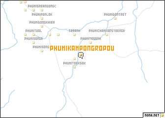
Phumĭ Kâmpóng Rôpŏu (Bătdâmbâng, Cambodia)Phumĭ Kâmpóng Rôpŏu is a town in the Bătdâmbâng region of Cambodia. An overview map of the region around Phumĭ Kâmpóng Rôpŏu is displayed below.
regional and 3d topo map of Phumĭ Kâmpóng Rôpŏu, Cambodia ::
Phumĭ Kâmpóng Rôpŏu airports ::
The nearest airport is REP - Siem-reap Siem Reap, located 140.0 km north east of Phumĭ Kâmpóng Rôpŏu.
Other airports nearby include UTP - Rayong U Taphao Intl (202.8 km west), PNH - Phnom-penh Phnom Penh Intl (242.2 km south east), Nearby towns ::
Phumĭ Châmlâng Rômeăng (1.8km west) //
Phumĭ Tœ̆k Sŏk (2.6km south west) //
Phumĭ Ta Sanh (4.1km north east) //
Ta Sanh (5.8km north) //
Phumĭ Châmkar Stœ̆ng (1) (7.8km north east) //
Phumĭ Ânlóng Puŏk (7.8km north west) //
Phumĭ Kâmchăng (9.1km north west) //
[all distances 'as the bird flies' and approximate] 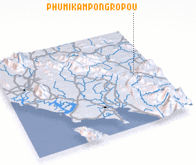 Places with similar names to Phumĭ Kâmpóng Rôpŏu, Cambodia :: Disclaimer :: Information on this page comes without warranty of any kind |
||
|
Where is Phumĭ Kâmpóng Rôpŏu? Elevation and coordinates ::
Latitude (lat): 12°33'0"N Longitude (lon): 102°52'0"E
Elevation (approx.): 130m (map arrows pan, magnifying glasses zoom) |
||
|
Visiting Phumĭ Kâmpóng Rôpŏu? Hotel/Accommodation ::
Book a hotel in Phumĭ Kâmpóng Rôpŏu Travel Guide ::
Buy a travel guide for Cambodia rental cars ::
car rental offers GPS waypoint ::
download a GPX waypoint (PoI) of Phumĭ Kâmpóng Rôpŏu for your GPS receiver
|
||