|
search place name
|
||
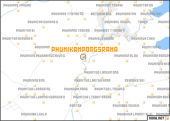
Phumĭ Kâmpóng Srâmâ (Bătdâmbâng, Cambodia)Phumĭ Kâmpóng Srâmâ is a town in the Bătdâmbâng region of Cambodia. An overview map of the region around Phumĭ Kâmpóng Srâmâ is displayed below.
regional and 3d topo map of Phumĭ Kâmpóng Srâmâ, Cambodia ::
Phumĭ Kâmpóng Srâmâ airports ::
The nearest airport is REP - Siem-reap Siem Reap, located 82.5 km north east of Phumĭ Kâmpóng Srâmâ.
Other airports nearby include NAK - Nakhon Ratchasima Khorat (242.6 km north west), PNH - Phnom-penh Phnom Penh Intl (244.4 km south east), Nearby towns ::
Phumĭ Chheutéal (0.0km north) //
Phumĭ Krâpeu Ha (0.0km north) //
Phumĭ Ta Nŏk (1.9km north) //
Phumĭ Kâmpóng Chhlâng (1.8km east) //
Phumĭ Bát Sala (1.9km south) //
Phumĭ Khsăch Poŭy (2.6km north east) //
Phumĭ Bay Dâmrăm (3.7km south) //
Phumĭ Ânlóng Svay (4.1km north east) //
Phumĭ Bœ̆ng Reăng (4.1km north west) //
Phumĭ O Réam (4.1km north west) //
Phumĭ Chêng Kda (4.1km north west) //
Phumĭ Ânlóng Thmei (4.1km south west) //
Phumĭ Krâla Peăh (4.1km south west) //
Phumĭ Kâmpóng Séma (5.2km north east) //
Phumĭ Kâmpóng Âmpĭl (5.2km north east) //
Phumĭ Slâ Kram (1) (5.2km north east) //
Phumĭ Tuŏl Ângkrông (5.2km south east) //
Phumĭ Prey Kon Khla (5.6km north) //
Phumĭ Ândong Pring (5.6km north) //
Phumĭ Kâmpov (5.7km west) //
Phumĭ Tuŏl Bay Dâmrăm (5.8km south) //
Phumĭ Prey Rôkar (5.8km north) //
Phumĭ Dăk Sâsâr (5.8km north) //
Phumĭ Kânhchraông (5.8km south) //
Phumĭ Âu Măl (5.8km north) //
Phumĭ Svay Chh'êh (6.6km north east) //
Phumĭ Bœ̆ng Âmpĭl (6.6km north west) //
Phumĭ Kdaông Khang Tbong (7.2km west) //
Phumĭ Phnum Sâmpŏu (7.5km west) //
[all distances 'as the bird flies' and approximate]  Places with similar names to Phumĭ Kâmpóng Srâmâ, Cambodia :: Disclaimer :: Information on this page comes without warranty of any kind |
||
|
Where is Phumĭ Kâmpóng Srâmâ? Elevation and coordinates ::
Latitude (lat): 13°1'0"N Longitude (lon): 103°10'0"E
Elevation (approx.): 18m (map arrows pan, magnifying glasses zoom) |
||
|
Visiting Phumĭ Kâmpóng Srâmâ? Hotel/Accommodation ::
Book a hotel in Phumĭ Kâmpóng Srâmâ Travel Guide ::
Buy a travel guide for Cambodia rental cars ::
car rental offers GPS waypoint ::
download a GPX waypoint (PoI) of Phumĭ Kâmpóng Srâmâ for your GPS receiver
|
||