|
search place name
|
||
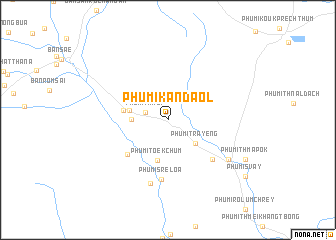
Phumĭ Kândaôl (Bătdâmbâng, Cambodia)Phumĭ Kândaôl is a town in the Bătdâmbâng region of Cambodia. An overview map of the region around Phumĭ Kândaôl is displayed below.
regional and 3d topo map of Phumĭ Kândaôl, Cambodia ::
Phumĭ Kândaôl airports ::
The nearest airport is REP - Siem-reap Siem Reap, located 109.8 km south east of Phumĭ Kândaôl.
Other airports nearby include NAK - Nakhon Ratchasima Khorat (143.4 km north west), UTP - Rayong U Taphao Intl (259.2 km south west), Nearby towns ::
Phumĭ Thmei (2.6km west) //
Phumĭ Trâyêng (4.0km south east) //
Phumĭ Sdau (3.9km west) //
Phumĭ Srăh Ngu (4.3km west) //
Phumĭ Tœ̆k Chŭm (4.6km south) //
Phumĭ Koŭk Rômiĕt (5.0km west) //
Koŭk Préch (5.8km south west) //
Phumĭ Srê Mémay (6.5km south east) //
Phumĭ Srê Loâ (6.7km south) //
Phumĭ Ka Sŭng (7.3km south) //
Phumĭ Ânlóng Khlông (8.0km south east) //
Phumĭ Thmâ Pôk (9.5km south east) //
Phumĭ Svay (10.5km south east) //
[all distances 'as the bird flies' and approximate] 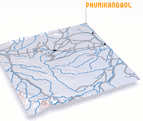 Places with similar names to Phumĭ Kândaôl, Cambodia ::
// Phumĭ Kândal (KH)
// Phumĭ Kândal (KH)
// Phumĭ Kândal (KH)
// Phumĭ Kândal (KH)
// Phumĭ Kândal (KH)
// Phumĭ Kândal (KH)
// Phumĭ Kândal (KH)
// Phumĭ Kândal (KH)
// Phumĭ Kândal (KH)
// Phumĭ Kândal (KH)
Disclaimer :: Information on this page comes without warranty of any kind |
||
|
Where is Phumĭ Kândaôl? Elevation and coordinates ::
Latitude (lat): 13°59'24"N Longitude (lon): 102°59'20"E
Elevation (approx.): 51m (map arrows pan, magnifying glasses zoom) |
||
|
Visiting Phumĭ Kândaôl? Hotel/Accommodation ::
Book a hotel in Phumĭ Kândaôl Travel Guide ::
Buy a travel guide for Cambodia rental cars ::
car rental offers GPS waypoint ::
download a GPX waypoint (PoI) of Phumĭ Kândaôl for your GPS receiver
|
||