|
search place name
|
||
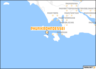
Phumĭ Kaôh Rœssei (Kâmpôt, Cambodia)Phumĭ Kaôh Rœssei is a town in the Kâmpôt region of Cambodia. An overview map of the region around Phumĭ Kaôh Rœssei is displayed below.
regional and 3d topo map of Phumĭ Kaôh Rœssei, Cambodia ::
Phumĭ Kaôh Rœssei airports ::
The nearest airport is PNH - Phnom-penh Phnom Penh Intl, located 181.4 km north east of Phumĭ Kaôh Rœssei.
Nearby towns ::
Phumĭ Kaôh Ta Kiĕv (1.8km east) //
Phumĭ Kaôh Ta Kiĕv Leu (3.6km east) //
Phumĭ Kaôh Ta Kiĕv Kraôm (3.6km east) //
Phsar Réam (5.5km east) //
Phumĭ Moăt Péam (5.9km north) //
Phumĭ Dong (6.6km north east) //
Phumĭ Ta Ŏng (7.6km north) //
Phumĭ Péam (2) (7.8km north east) //
Phumĭ Sala Chăs (8.2km north east) //
Phumĭ Péam (1) (8.3km north east) //
Phumĭ Thmâ Ângkêb (9.2km north east) //
Phumĭ Ângk (10.4km north east) //
[all distances 'as the bird flies' and approximate]  Places with similar names to Phumĭ Kaôh Rœssei, Cambodia ::
// Phumĭ Chrás (KH)
// Phumĭ Chrés (KH)
// Phumĭ Chrés (KH)
// Phumĭ Chrés (KH)
// Phumĭ Chrés (KH)
// Phumĭ Chrés (KH)
// Phumĭ Chrés (KH)
// Phumĭ Chrés (KH)
// Phumĭ Chrés (KH)
// Phumĭ Chrés (KH)
Disclaimer :: Information on this page comes without warranty of any kind |
||
|
Where is Phumĭ Kaôh Rœssei? Elevation and coordinates ::
Latitude (lat): 10°30'0"N Longitude (lon): 103°34'0"E
Elevation (approx.): -32768m (map arrows pan, magnifying glasses zoom) |
||
|
Visiting Phumĭ Kaôh Rœssei? Hotel/Accommodation ::
Book a hotel in Phumĭ Kaôh Rœssei Travel Guide ::
Buy a travel guide for Cambodia rental cars ::
car rental offers GPS waypoint ::
download a GPX waypoint (PoI) of Phumĭ Kaôh Rœssei for your GPS receiver
|
||