|
search place name
|
||
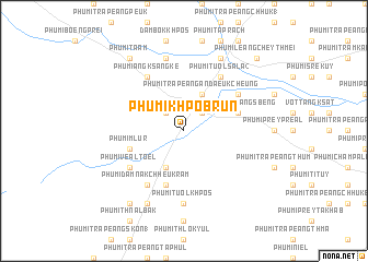
Phumĭ Khpôb Rŭn (Kâmpôt, Cambodia)Phumĭ Khpôb Rŭn is a town in the Kâmpôt region of Cambodia. An overview map of the region around Phumĭ Khpôb Rŭn is displayed below.
regional and 3d topo map of Phumĭ Khpôb Rŭn, Cambodia ::
Phumĭ Khpôb Rŭn airports ::
The nearest airport is PNH - Phnom-penh Phnom Penh Intl, located 67.6 km north east of Phumĭ Khpôb Rŭn.
Nearby towns ::
Phumĭ Thnál Thlôk (2.6km north west) //
Phumĭ Trâpeăng Ândaeuk Tbong (2.6km north east) //
Phumĭ Prey Khley (4.1km south west) //
Phumĭ Trâpeăng Ândaeuk Cheung (4.1km north east) //
Phumĭ Băt Chônhchiĕn (5.8km south) //
Phumĭ Trâpeăng Sbêng (5.8km east) //
Phumĭ Mlur (5.8km west) //
Phumĭ Tnaôt Chŭm (5.8km east) //
Phumĭ Ângk Sângkê (6.6km north west) //
Phumĭ Prâlay Méas (6.6km north east) //
Phumĭ Áng Dong (6.6km south west) //
Phumĭ Dâmnăk Chheu Krâm (6.6km south west) //
Phumĭ Véal Tœ̆l (6.6km south west) //
Phumĭ Tuŏl Sala (2) (6.6km north east) //
Phumĭ Tuŏl Khpós (7.4km south) //
Phumĭ Khpôb Svay (7.6km north) //
Phumĭ Prey Vêng (8.3km south west) //
Phumĭ Dâmnăk Khlŏng (8.3km north east) //
Phumĭ Ta Ăm (9.2km north west) //
Phumĭ Srê Kruŏs (9.2km south west) //
Phumĭ Leăng Chey Thmei (10.4km north east) //
[all distances 'as the bird flies' and approximate]  Places with similar names to Phumĭ Khpôb Rŭn, Cambodia :: Disclaimer :: Information on this page comes without warranty of any kind |
||
|
Where is Phumĭ Khpôb Rŭn? Elevation and coordinates ::
Latitude (lat): 11°3'0"N Longitude (lon): 104°29'0"E
Elevation (approx.): 43m (map arrows pan, magnifying glasses zoom) |
||
|
Visiting Phumĭ Khpôb Rŭn? Hotel/Accommodation ::
Book a hotel in Phumĭ Khpôb Rŭn Travel Guide ::
Buy a travel guide for Cambodia rental cars ::
car rental offers GPS waypoint ::
download a GPX waypoint (PoI) of Phumĭ Khpôb Rŭn for your GPS receiver
|
||