|
search place name
|
||
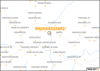
Phumĭ Kóng Nang (Rôtânăh Kiri, Cambodia)Phumĭ Kóng Nang is a town in the Rôtânăh Kiri region of Cambodia. An overview map of the region around Phumĭ Kóng Nang is displayed below.
regional and 3d topo map of Phumĭ Kóng Nang, Cambodia ::
Phumĭ Kóng Nang airports ::
The nearest airport is PKZ - Pakse, located 204.9 km north west of Phumĭ Kóng Nang.
Nearby towns ::
Phumĭ Cham (2.6km north west) //
Bâ Nêv (3.6km east) //
Phumĭ Pachŭn Nâng Kung (4.1km south west) //
Phumĭ Chanŏb (4.0km north west) //
Phumĭ Lum Bang (4.0km north east) //
Phumĭ Ban Kon (4.1km north east) //
Phumĭ Bating Kâb (5.6km south) //
Phumĭ La Œn (5.7km west) //
Phumĭ Bŏs Poy (7.8km north west) //
Phumĭ Kăb Nŭy (8.2km south east) //
Phumĭ Anlóng Svay (9.1km south west) //
Phumĭ Yeăks Laôm (9.2km south west) //
Phumĭ Labăng (1) (9.2km north west) //
[all distances 'as the bird flies' and approximate] 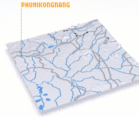 Places with similar names to Phumĭ Kóng Nang, Cambodia ::
// Phumĭ Kâng Néang (KH)
Disclaimer :: Information on this page comes without warranty of any kind |
||
|
Where is Phumĭ Kóng Nang? Elevation and coordinates ::
Latitude (lat): 13°47'0"N Longitude (lon): 107°5'0"E
Elevation (approx.): 309m (map arrows pan, magnifying glasses zoom) |
||
|
Visiting Phumĭ Kóng Nang? Hotel/Accommodation ::
Book a hotel in Phumĭ Kóng Nang Travel Guide ::
Buy a travel guide for Cambodia rental cars ::
car rental offers GPS waypoint ::
download a GPX waypoint (PoI) of Phumĭ Kóng Nang for your GPS receiver
|
||