|
search place name
|
||
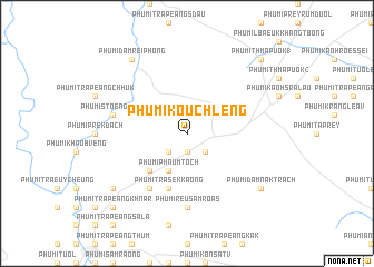
Phumĭ Koŭch Léng (Kâmpôt, Cambodia)Phumĭ Koŭch Léng is a town in the Kâmpôt region of Cambodia. An overview map of the region around Phumĭ Koŭch Léng is displayed below.
regional and 3d topo map of Phumĭ Koŭch Léng, Cambodia ::
Phumĭ Koŭch Léng airports ::
The nearest airport is PNH - Phnom-penh Phnom Penh Intl, located 111.4 km north east of Phumĭ Koŭch Léng.
Nearby towns ::
Châkrei Ting (1.9km south) //
Phumĭ Prey Thnóng (2.6km south east) //
Phumĭ Chăng Chaeu (2.6km south west) //
Phumĭ Phnum Toch (4.1km south west) //
Phumĭ Châkrei Ting (5.2km south west) //
Phumĭ Trâsék Kaông (5.9km south) //
Phumĭ Tani (6.6km south west) //
Phumĭ Reu Sâmroăs (7.4km south) //
Phumĭ Stœ̆ng Kăch (7.5km west) //
Phumĭ Dâmrei Phŏng (9.2km north west) //
Phumĭ Dâmnăk Trach (9.2km south east) //
Phumĭ Trâpeăng Pring (9.2km south west) //
Phumĭ Thmâ Puŏk (1) (10.4km north east) //
Phumĭ Trâpeăng Khnar (10.4km south west) //
[all distances 'as the bird flies' and approximate] 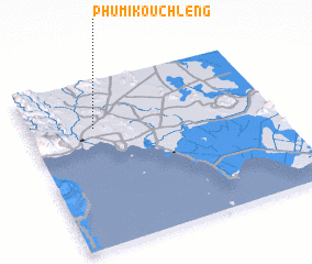 Places with similar names to Phumĭ Koŭch Léng, Cambodia :: Disclaimer :: Information on this page comes without warranty of any kind |
||
|
Where is Phumĭ Koŭch Léng? Elevation and coordinates ::
Latitude (lat): 10°43'0"N Longitude (lon): 104°16'0"E
Elevation (approx.): 19m (map arrows pan, magnifying glasses zoom) |
||
|
Visiting Phumĭ Koŭch Léng? Hotel/Accommodation ::
Book a hotel in Phumĭ Koŭch Léng Travel Guide ::
Buy a travel guide for Cambodia rental cars ::
car rental offers GPS waypoint ::
download a GPX waypoint (PoI) of Phumĭ Koŭch Léng for your GPS receiver
|
||