|
search place name
|
||
Phumĭ Koŭk Ta Tĭn (Bătdâmbâng, Cambodia)Phumĭ Koŭk Ta Tĭn is a town in the Bătdâmbâng region of Cambodia. An overview map of the region around Phumĭ Koŭk Ta Tĭn is displayed below.
regional and 3d topo map of Phumĭ Koŭk Ta Tĭn, Cambodia ::

Phumĭ Koŭk Ta Tĭn airports ::
The nearest airport is REP - Siem-reap Siem Reap, located 90.7 km south east of Phumĭ Koŭk Ta Tĭn.
Other airports nearby include NAK - Nakhon Ratchasima Khorat (162.8 km north west), Nearby towns ::
Phumĭ Preăh (0.0km north) //
Phumĭ Tut Char (3.6km west) //
Phumĭ Thmei Khang Tbong (4.0km north west) //
Phumĭ Thmei Kândal (4.0km north west) //
Phumĭ Phkŏâm (4.1km south east) //
Phumĭ Dœ (4.0km south west) //
Phumĭ Sdau (1) (4.0km south west) //
Phumĭ Tôtéal (4.0km south west) //
Phumĭ Chônléas Dai (5.4km east) //
Phumĭ Yéang Viĕn (5.8km south) //
Phumĭ Rôlum Chrey (6.5km north west) //
Phumĭ Kăb Chaôr (6.5km north west) //
Phumĭ Koŭk Svay (1) (6.5km north west) //
Phumĭ Ta Trai (7.2km east) //
Phumĭ Mau (7.4km south) //
Phumĭ Koŭk Khpós (7.4km west) //
Phumĭ Bântéay Baôs (8.2km south west) //
Phumĭ Svay (9.2km north west) //
Phumĭ Pônley (9.1km south east) //
[all distances 'as the bird flies' and approximate] 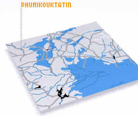 Places with similar names to Phumĭ Koŭk Ta Tĭn, Cambodia :: Disclaimer :: Information on this page comes without warranty of any kind |
||
|
Where is Phumĭ Koŭk Ta Tĭn? Elevation and coordinates ::
Latitude (lat): 13°52'0"N Longitude (lon): 103°7'0"E
Elevation (approx.): 29m (map arrows pan, magnifying glasses zoom) |
||
|
Visiting Phumĭ Koŭk Ta Tĭn? Hotel/Accommodation ::
Book a hotel in Phumĭ Koŭk Ta Tĭn Travel Guide ::
Buy a travel guide for Cambodia rental cars ::
car rental offers GPS waypoint ::
download a GPX waypoint (PoI) of Phumĭ Koŭk Ta Tĭn for your GPS receiver
|
||