|
search place name
|
||
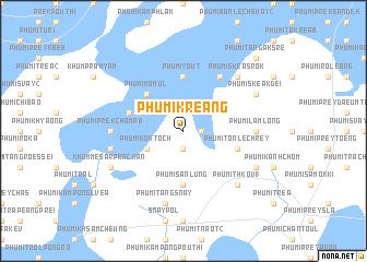
Phumĭ Kreăng (Prey Vêng, Cambodia)Phumĭ Kreăng is a town in the Prey Vêng region of Cambodia. An overview map of the region around Phumĭ Kreăng is displayed below.
regional and 3d topo map of Phumĭ Kreăng, Cambodia ::
Phumĭ Kreăng airports ::
The nearest airport is PNH - Phnom-penh Phnom Penh Intl, located 48.0 km south west of Phumĭ Kreăng.
Other airports nearby include SGN - Ho Chi Minh City Tansonnhat Intl (186.0 km south east), REP - Siem-reap Siem Reap (239.9 km north west), Nearby towns ::
Phumĭ Svay (1) (1.9km south) //
Phumĭ Chrey Prey Dâmbâng (1.8km east) //
Phumĭ Kôk Toch (4.1km south west) //
Phumĭ Mômŭl (5.2km north west) //
Phumĭ Sânlŭng (5.6km south) //
Phumĭ Yoŭt (5.6km north) //
Phumĭ Tônlé Chrey (5.8km east) //
Phumĭ Âmpĭl (2) (5.8km west) //
Phumĭ Chumtéav Mau (6.6km north east) //
Phumĭ Prêk Châmpa (7.3km west) //
Phumĭ Lămlong (7.3km east) //
Phumĭ Kâmpóng Tréa (7.5km west) //
Phumĭ Tăng Snay (7.6km south) //
Phumĭ Thkov (1) (7.8km south east) //
Phumĭ Skéa Srŏk (7.8km north east) //
Khŭm Mésâr Prâchăn (8.1km south west) //
Phumĭ Dong (8.1km south east) //
Phumĭ Skéa Kdei (8.1km north east) //
Phumĭ Ta Ngâk Srê (10.4km north east) //
[all distances 'as the bird flies' and approximate]  Places with similar names to Phumĭ Kreăng, Cambodia ::
// Phumĭ Chrânâk (KH)
// Phumĭ Chrânik (KH)
// Phumĭ Chrânik (KH)
// Phumĭ Chrêng (KH)
// Phumĭ Chring (KH)
// Phumĭ Chroŭng (KH)
// Phumĭ Chrŭng (KH)
// Phumĭ Karâng (KH)
// Phumĭ Kay Roŭng (KH)
// Phumĭ Krăng (KH)
Disclaimer :: Information on this page comes without warranty of any kind |
||
|
Where is Phumĭ Kreăng? Elevation and coordinates ::
Latitude (lat): 11°45'0"N Longitude (lon): 105°14'0"E
Elevation (approx.): 13m (map arrows pan, magnifying glasses zoom) |
||
|
Visiting Phumĭ Kreăng? Hotel/Accommodation ::
Book a hotel in Phumĭ Kreăng Travel Guide ::
Buy a travel guide for Cambodia rental cars ::
car rental offers GPS waypoint ::
download a GPX waypoint (PoI) of Phumĭ Kreăng for your GPS receiver
|
||