|
search place name
|
||
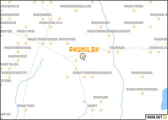
Phumĭ L'ák (Kâmpóng Cham, Cambodia)Phumĭ L'ák is a town in the Kâmpóng Cham region of Cambodia. An overview map of the region around Phumĭ L'ák is displayed below.
regional and 3d topo map of Phumĭ L'ák, Cambodia ::
Phumĭ L'ák airports ::
The nearest airport is PNH - Phnom-penh Phnom Penh Intl, located 124.8 km west of Phumĭ L'ák.
Other airports nearby include SGN - Ho Chi Minh City Tansonnhat Intl (128.8 km south east), Nearby towns ::
Phumĭ Chimoăn (1.8km west) //
Phumĭ Âmpók (2.6km north east) //
Phumĭ Kôr (2.6km north east) //
Phumĭ Trâpeăng Pring (2.6km south west) //
Phumĭ Preăh Phdau (3.7km south) //
Phumĭ Trâpeăng Rumsêng (4.1km south east) //
Phumĭ Krêk (5.2km north west) //
Phumĭ Kbal Dâmrei (5.2km south west) //
Phumĭ Chipeăng (5.7km east) //
Phumĭ S'âm (7.5km east) //
Phumĭ Sâmakôm Kausu Khmêr (7.8km north east) //
Phumĭ Mémay (8.3km north east) //
Phumĭ Krânhung (8.1km north west) //
Phumĭ Véal Mlu (10.4km north west) //
[all distances 'as the bird flies' and approximate] 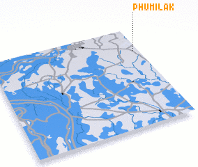 Places with similar names to Phumĭ L'ák, Cambodia ::
// Famalicão (PT)
// Famalicão (PT)
// Famalicão (PT)
// Famalicão (PT)
// Famelga (ES)
// Phumĭ Âu Lœ̆k (KH)
// Phumĭ L'ák (KH)
// Phumĭ L'ák (KH)
// Phumĭ L'ák (KH)
// Phumĭ L'ák (KH)
Disclaimer :: Information on this page comes without warranty of any kind |
||
|
Where is Phumĭ L'ák? Elevation and coordinates ::
Latitude (lat): 11°46'0"N Longitude (lon): 105°58'0"E
Elevation (approx.): 35m (map arrows pan, magnifying glasses zoom) |
||
|
Visiting Phumĭ L'ák? Hotel/Accommodation ::
Book a hotel in Phumĭ L'ák Travel Guide ::
Buy a travel guide for Cambodia rental cars ::
car rental offers GPS waypoint ::
download a GPX waypoint (PoI) of Phumĭ L'ák for your GPS receiver
|
||