|
search place name
|
||
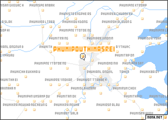
Phumĭ Poŭthĭ Mâ Srei (Bătdâmbâng, Cambodia)Phumĭ Poŭthĭ Mâ Srei is a town in the Bătdâmbâng region of Cambodia. An overview map of the region around Phumĭ Poŭthĭ Mâ Srei is displayed below.
regional and 3d topo map of Phumĭ Poŭthĭ Mâ Srei, Cambodia ::
Phumĭ Poŭthĭ Mâ Srei airports ::
The nearest airport is REP - Siem-reap Siem Reap, located 73.9 km north east of Phumĭ Poŭthĭ Mâ Srei.
Other airports nearby include NAK - Nakhon Ratchasima Khorat (234.8 km north west), PNH - Phnom-penh Phnom Penh Intl (249.3 km south east), Nearby towns ::
Phumĭ Don Téav (1.9km north) //
Bătdâmbâng (1.9km south) //
Phumĭ Vôtt Sophi (1.8km east) //
Phumĭ Vôtt Nôréa (1.8km east) //
Phumĭ Sala Ta Ŏng (2.6km north east) //
Phumĭ Kântuŏt (2.6km north east) //
Phumĭ Sna Pi Mŭk (1) (4.1km north east) //
Phumĭ Kông Tum (4.1km north east) //
Phumĭ Péam Êk (4.1km north east) //
Phumĭ Ândong Chénh (4.1km south west) //
Phumĭ Prêk Kroch (5.2km north east) //
Phumĭ Prêk Nôrĭn (5.2km north east) //
Phumĭ Prey Tôtœ̆ng (5.2km north west) //
Phumĭ Ânlóng Vĭl (5.2km south east) //
Phumĭ Svay Chh'êh (5.6km south) //
Phumĭ Kâ Rôhal (5.6km north) //
Phumĭ O Môni (1) (5.7km east) //
Phumĭ Vôtt Ta Mœ̆m (5.8km south) //
Phumĭ Prey Tôtœ̆ng (5.8km north) //
Phumĭ Prêk Chhdaô (5.8km north) //
Phumĭ Cha Dêk (6.6km south east) //
Phumĭ Kâmpóng Băk Daôk (6.6km south east) //
Phumĭ Trang (6.6km north west) //
Phumĭ O Tôtœ̆ng (6.6km north east) //
Phumĭ Prey Kon Khla (6.6km south west) //
Phumĭ Ândong Pring (6.6km south west) //
Phumĭ Kâmpóng Séma (7.4km south) //
Phumĭ Slâ Kram (1) (7.4km south) //
Phumĭ Kâmpóng Âmpĭl (7.4km south) //
[all distances 'as the bird flies' and approximate]  Places with similar names to Phumĭ Poŭthĭ Mâ Srei, Cambodia :: Disclaimer :: Information on this page comes without warranty of any kind |
||
|
Where is Phumĭ Poŭthĭ Mâ Srei? Elevation and coordinates ::
Latitude (lat): 13°7'0"N Longitude (lon): 103°12'0"E
Elevation (approx.): 20m (map arrows pan, magnifying glasses zoom) |
||
|
Visiting Phumĭ Poŭthĭ Mâ Srei? Hotel/Accommodation ::
Book a hotel in Phumĭ Poŭthĭ Mâ Srei Travel Guide ::
Buy a travel guide for Cambodia rental cars ::
car rental offers GPS waypoint ::
download a GPX waypoint (PoI) of Phumĭ Poŭthĭ Mâ Srei for your GPS receiver
|
||