|
search place name
|
||
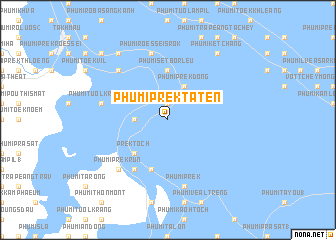
Phumĭ Prêk Ta Tĕn (Bântéay Méan Cheăy, Cambodia)Phumĭ Prêk Ta Tĕn is a town in the Bântéay Méan Cheăy region of Cambodia. An overview map of the region around Phumĭ Prêk Ta Tĕn is displayed below.
regional and 3d topo map of Phumĭ Prêk Ta Tĕn, Cambodia ::
Phumĭ Prêk Ta Tĕn airports ::
The nearest airport is PNH - Phnom-penh Phnom Penh Intl, located 27.7 km north west of Phumĭ Prêk Ta Tĕn.
Other airports nearby include SGN - Ho Chi Minh City Tansonnhat Intl (186.4 km east), Nearby towns ::
Phumĭ Kâmpóng Svay (1.9km north) //
Phumĭ Prêk Trêng (1.9km north) //
Phumĭ Rôkar Khpós (3.6km west) //
Phumĭ Kbal Kaôh (2) (3.6km west) //
Phumĭ Prêk Dong (4.1km north east) //
Phumĭ Barên (1) (5.2km south west) //
Prêk Toch (5.2km south west) //
Phumĭ Sĕtbor Leu (5.6km north) //
Phumĭ Poŭthĭ Leu (5.8km south) //
Phumĭ Prêk Kôy (6.6km south west) //
Phumĭ Tuŏl Krâsăng (7.5km west) //
Phumĭ Rœssei Srŏk (7.6km north) //
Phumĭ Prêk (7.6km south) //
Phumĭ Kraôl Krâbei (7.8km north west) //
Phumĭ Prêk Rŭn (7.8km south west) //
Phumĭ Kêt Cháng (9.2km north east) //
Phumĭ Prêk Thmei (1) (9.2km north west) //
Phumĭ Kaôh Krâbei (10.4km north west) //
[all distances 'as the bird flies' and approximate] 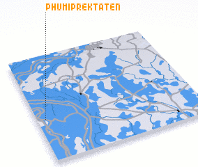 Places with similar names to Phumĭ Prêk Ta Tĕn, Cambodia :: Disclaimer :: Information on this page comes without warranty of any kind |
||
|
Where is Phumĭ Prêk Ta Tĕn? Elevation and coordinates ::
Latitude (lat): 11°24'0"N Longitude (lon): 105°3'0"E
Elevation (approx.): 7m (map arrows pan, magnifying glasses zoom) |
||
|
Visiting Phumĭ Prêk Ta Tĕn? Hotel/Accommodation ::
Book a hotel in Phumĭ Prêk Ta Tĕn Travel Guide ::
Buy a travel guide for Cambodia rental cars ::
car rental offers GPS waypoint ::
download a GPX waypoint (PoI) of Phumĭ Prêk Ta Tĕn for your GPS receiver
|
||