|
search place name
|
||
Phumĭ Prey Ta Hiĕch (Kâmpóng Spœ, Cambodia)Phumĭ Prey Ta Hiĕch is a town in the Kâmpóng Spœ region of Cambodia. An overview map of the region around Phumĭ Prey Ta Hiĕch is displayed below.
regional and 3d topo map of Phumĭ Prey Ta Hiĕch, Cambodia ::

Phumĭ Prey Ta Hiĕch airports ::
The nearest airport is PNH - Phnom-penh Phnom Penh Intl, located 75.0 km east of Phumĭ Prey Ta Hiĕch.
Other airports nearby include REP - Siem-reap Siem Reap (222.1 km north), Nearby towns ::
Phumĭ Âmpĭl (1.9km south) //
Phumĭ Prey Trach (2.6km south east) //
Phumĭ Krăng Kroch (2.6km south east) //
Phumĭ Bântéay Rôkar (2.6km south west) //
Phumĭ Kâphĕn (2.6km north east) //
Phumĭ Krăng Kôr (3.6km east) //
Phumĭ Krăng Dei Vay (3.6km east) //
Phumĭ Dâk Pôr (4.1km north east) //
Phumĭ Trâpeăng Krănh (6.6km south west) //
Phumĭ Péch Ântóng (6.6km south west) //
Vôtt Châmbák (7.8km south west) //
Phumĭ Béng (7.8km south west) //
Phumĭ Kâmpóng Sala (8.3km south west) //
Phumĭ Krăng Chék (8.2km south west) //
Phumĭ Thmei (9.2km south west) //
Châmbák Dângkôm (9.2km south west) //
[all distances 'as the bird flies' and approximate] 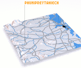 Places with similar names to Phumĭ Prey Ta Hiĕch, Cambodia :: Disclaimer :: Information on this page comes without warranty of any kind |
||
|
Where is Phumĭ Prey Ta Hiĕch? Elevation and coordinates ::
Latitude (lat): 11°26'0"N Longitude (lon): 104°10'0"E
Elevation (approx.): 74m (map arrows pan, magnifying glasses zoom) |
||
|
Visiting Phumĭ Prey Ta Hiĕch? Hotel/Accommodation ::
Book a hotel in Phumĭ Prey Ta Hiĕch Travel Guide ::
Buy a travel guide for Cambodia rental cars ::
car rental offers GPS waypoint ::
download a GPX waypoint (PoI) of Phumĭ Prey Ta Hiĕch for your GPS receiver
|
||