|
search place name
|
||
Phumĭ Rôkar Pôprăm (Kâmpóng Cham, Cambodia)Phumĭ Rôkar Pôprăm is a town in the Kâmpóng Cham region of Cambodia. An overview map of the region around Phumĭ Rôkar Pôprăm is displayed below.
regional and 3d topo map of Phumĭ Rôkar Pôprăm, Cambodia ::

Phumĭ Rôkar Pôprăm airports ::
The nearest airport is PNH - Phnom-penh Phnom Penh Intl, located 110.0 km south west of Phumĭ Rôkar Pôprăm.
Other airports nearby include SGN - Ho Chi Minh City Tansonnhat Intl (166.1 km south east), REP - Siem-reap Siem Reap (259.4 km north west), Nearby towns ::
Phumĭ Vihéar Sâmbo (2.6km south west) //
Phumĭ Kôr (3.7km south) //
Phumĭ Véal Khmŭm (3.7km south) //
Phumĭ Chŏng O (4.1km north west) //
Phumĭ Svay Yeăks (4.1km north east) //
Phumĭ Sâmbuŏr (5.6km south) //
Phumĭ Sângkê Kaông (6.6km north west) //
Phumĭ Ta Paô (6.6km north west) //
Phumĭ Trâpeăng Rœssei (6.6km north west) //
Phumĭ Chroŭy Kôr (7.5km west) //
Phumĭ Chrab (7.6km south) //
Phumĭ Kbal O (7.6km south) //
Phumĭ Lvéa Thum (7.6km south) //
Phumĭ Krângaôk (8.3km north west) //
Phumĭ Chŏâm Mlu (9.1km north east) //
Phumĭ Chhuk Sândŏl (10.4km north west) //
[all distances 'as the bird flies' and approximate] 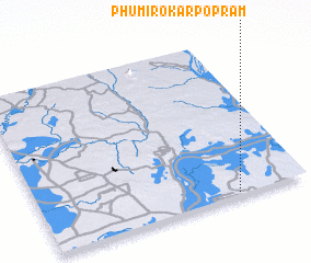 Places with similar names to Phumĭ Rôkar Pôprăm, Cambodia :: Disclaimer :: Information on this page comes without warranty of any kind |
||
|
Where is Phumĭ Rôkar Pôprăm? Elevation and coordinates ::
Latitude (lat): 12°1'0"N Longitude (lon): 105°44'0"E
Elevation (approx.): 26m (map arrows pan, magnifying glasses zoom) |
||
|
Visiting Phumĭ Rôkar Pôprăm? Hotel/Accommodation ::
Book a hotel in Phumĭ Rôkar Pôprăm Travel Guide ::
Buy a travel guide for Cambodia rental cars ::
car rental offers GPS waypoint ::
download a GPX waypoint (PoI) of Phumĭ Rôkar Pôprăm for your GPS receiver
|
||