|
search place name
|
||
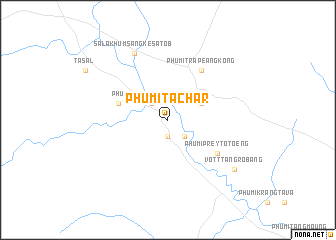
Phumĭ Ta Châr (Kâmpóng Spœ, Cambodia)Phumĭ Ta Châr is a town in the Kâmpóng Spœ region of Cambodia. An overview map of the region around Phumĭ Ta Châr is displayed below.
regional and 3d topo map of Phumĭ Ta Châr, Cambodia ::
Phumĭ Ta Châr airports ::
The nearest airport is PNH - Phnom-penh Phnom Penh Intl, located 74.3 km east of Phumĭ Ta Châr.
Other airports nearby include REP - Siem-reap Siem Reap (202.2 km north), Nearby towns ::
Phumĭ Sopi (1.9km south) //
Phumĭ Trâpeăng Thnóng (2.6km north west) //
Phumĭ Tnaôt Muŏy Daeum (2.6km south east) //
Phumĭ Taŏng Maông (2.6km south east) //
Phumĭ Chhkê Viĕn (4.1km north east) //
Knŏng Ay (5.8km west) //
Phumĭ Trâpeăng Kông (6.6km north east) //
Phumĭ Prey Tôtœ̆ng (6.6km south east) //
Phumĭ Châmpei (6.6km south east) //
Sala Khŭm Sângkê Satôb (8.3km north west) //
Phumĭ Dei Chhnăng (9.1km south east) //
Vôtt Tăng Rôbâng (9.1km south east) //
[all distances 'as the bird flies' and approximate]  Places with similar names to Phumĭ Ta Châr, Cambodia ::
// Phumĭ Ta Châr (KH)
// Phumĭ Ta Chhôr (KH)
Disclaimer :: Information on this page comes without warranty of any kind |
||
|
Where is Phumĭ Ta Châr? Elevation and coordinates ::
Latitude (lat): 11°37'0"N Longitude (lon): 104°10'0"E
Elevation (approx.): 70m (map arrows pan, magnifying glasses zoom) |
||
|
Visiting Phumĭ Ta Châr? Hotel/Accommodation ::
Book a hotel in Phumĭ Ta Châr Travel Guide ::
Buy a travel guide for Cambodia rental cars ::
car rental offers GPS waypoint ::
download a GPX waypoint (PoI) of Phumĭ Ta Châr for your GPS receiver
|
||