|
search place name
|
||
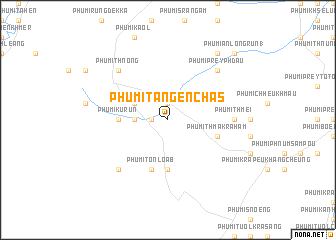
Phumĭ Ta Ngên Chăs (Bătdâmbâng, Cambodia)Phumĭ Ta Ngên Chăs is a town in the Bătdâmbâng region of Cambodia. An overview map of the region around Phumĭ Ta Ngên Chăs is displayed below.
regional and 3d topo map of Phumĭ Ta Ngên Chăs, Cambodia ::
Phumĭ Ta Ngên Chăs airports ::
The nearest airport is REP - Siem-reap Siem Reap, located 97.6 km north east of Phumĭ Ta Ngên Chăs.
Other airports nearby include UTP - Rayong U Taphao Intl (218.9 km west), NAK - Nakhon Ratchasima Khorat (228.6 km north west), PNH - Phnom-penh Phnom Penh Intl (263.1 km south east), Nearby towns ::
Phumĭ Phnum Khpós (1.8km west) //
Phumĭ Ta Ngên (1.9km north) //
Phumĭ Kâmping Puŏy (3.6km west) //
Phumĭ Prey Paôy (4.1km north west) //
Phumĭ Ânlóng Svay (5.4km west) //
Phumĭ Ku Rŭn (5.4km west) //
Phumĭ Bœ̆ng Krâsar (5.6km south) //
Phumĭ Tônloăb (5.8km south) //
Phumĭ Thmâ Krâhâm (5.7km east) //
Phumĭ Thmei (7.2km east) //
Phumĭ Kruŏs Chĭt (7.8km north east) //
Phumĭ Prey Phdau (7.8km north east) //
Phumĭ Thnóng (7.8km north west) //
Phumĭ Chi Nók (7.8km south west) //
Phumĭ Ânlóng Kruŏs (9.2km north east) //
Phumĭ Ânlóng Rŭn (1) (10.3km north east) //
[all distances 'as the bird flies' and approximate] 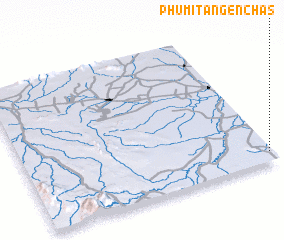 Places with similar names to Phumĭ Ta Ngên Chăs, Cambodia ::
// Phumĭ Ta Ngên Chăs (KH)
Disclaimer :: Information on this page comes without warranty of any kind |
||
|
Where is Phumĭ Ta Ngên Chăs? Elevation and coordinates ::
Latitude (lat): 13°4'0"N Longitude (lon): 102°59'0"E
Elevation (approx.): 27m (map arrows pan, magnifying glasses zoom) |
||
|
Visiting Phumĭ Ta Ngên Chăs? Hotel/Accommodation ::
Book a hotel in Phumĭ Ta Ngên Chăs Travel Guide ::
Buy a travel guide for Cambodia rental cars ::
car rental offers GPS waypoint ::
download a GPX waypoint (PoI) of Phumĭ Ta Ngên Chăs for your GPS receiver
|
||