|
search place name
|
||
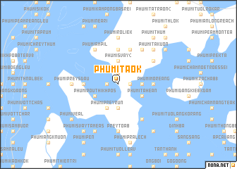
Phumĭ Ta Ok (Prey Vêng, Cambodia)Phumĭ Ta Ok is a town in the Prey Vêng region of Cambodia. An overview map of the region around Phumĭ Ta Ok is displayed below.
regional and 3d topo map of Phumĭ Ta Ok, Cambodia ::
Phumĭ Ta Ok airports ::
The nearest airport is PNH - Phnom-penh Phnom Penh Intl, located 79.2 km north west of Phumĭ Ta Ok.
Other airports nearby include SGN - Ho Chi Minh City Tansonnhat Intl (144.3 km east), Nearby towns ::
Phumĭ Bœ̆ng Daôl (1.8km west) //
Phumĭ Sabu (1.9km north) //
Phumĭ Ping Póng (1.8km east) //
Phumĭ Kâng Néang (3.7km south) //
Phumĭ Bâbŏs Rôluŏy (3.6km east) //
Phumĭ Svay (2) (3.7km north) //
Phumĭ Poŭthĭ Khpós (4.1km south west) //
Phumĭ Ta Héan (4.1km south east) //
Phumĭ Prey Rŭn (4.1km south west) //
Phumĭ Chrey (5.5km west) //
Phumĭ Réakóng Sat (5.6km north) //
Phumĭ Môréang (5.5km east) //
Phumĭ Ha (5.8km north) //
Phumĭ Âmpĭl (6.6km north west) //
Phumĭ Prey Ânchăn (6.6km north east) //
Phumĭ Poŭthĭ Chrêk (6.6km south east) //
Phumĭ Dâmrei Prĭch A Steăng (1) (6.6km north east) //
Prey Toăb (7.4km south) //
Phumĭ Rôliĕk (7.4km north) //
Phumĭ Sâmraông Krâchák (7.4km north) //
Phumĭ Prey Sdau (7.3km west) //
Phumĭ Ta Kuŏn (7.8km north east) //
Phumĭ Ta Oŭk (8.3km south west) //
Phumĭ Svay Ta Méas (9.2km south west) //
Phumĭ Dâmrei Slăb (9.2km south east) //
Phumĭ Sâmneuy (9.2km north east) //
Phumĭ Véal (9.2km south west) //
Phumĭ Chheutéal (9.2km south west) //
Phumĭ Thum (9.2km north east) //
[all distances 'as the bird flies' and approximate] 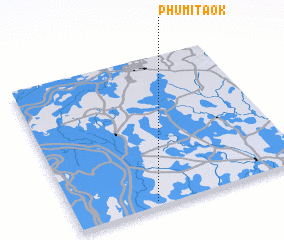 Places with similar names to Phumĭ Ta Ok, Cambodia ::
// Fomodoc (PH)
// Phumĭ Dêk (KH)
// Phumĭ O Ta Ki (KH)
// Phumĭ O Tuk (KH)
// Phumĭ Ta Aôk (KH)
// Phumĭ Ta Êk (KH)
// Phumĭ Ta Êk (KH)
// Phumĭ Ta Kai (KH)
// Phumĭ Takaô (KH)
// Phumĭ Ta Kaôh (KH)
Disclaimer :: Information on this page comes without warranty of any kind |
||
|
Where is Phumĭ Ta Ok? Elevation and coordinates ::
Latitude (lat): 11°2'0"N Longitude (lon): 105°21'0"E
Elevation (approx.): 12m (map arrows pan, magnifying glasses zoom) |
||
|
Visiting Phumĭ Ta Ok? Hotel/Accommodation ::
Book a hotel in Phumĭ Ta Ok Travel Guide ::
Buy a travel guide for Cambodia rental cars ::
car rental offers GPS waypoint ::
download a GPX waypoint (PoI) of Phumĭ Ta Ok for your GPS receiver
|
||