|
search place name
|
||
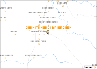
Phumĭ Thmâ Hal Dei Krâhâm (Krâchéh, Cambodia)Phumĭ Thmâ Hal Dei Krâhâm is a town in the Krâchéh region of Cambodia. An overview map of the region around Phumĭ Thmâ Hal Dei Krâhâm is displayed below.
regional and 3d topo map of Phumĭ Thmâ Hal Dei Krâhâm, Cambodia ::
Phumĭ Thmâ Hal Dei Krâhâm airports ::
The nearest airport is SGN - Ho Chi Minh City Tansonnhat Intl, located 138.0 km south of Phumĭ Thmâ Hal Dei Krâhâm.
Other airports nearby include PNH - Phnom-penh Phnom Penh Intl (183.7 km west), Nearby towns ::
Phumĭ Kâmlêk (1.8km west) //
Phumĭ Lmut (2.6km north west) //
Snuŏl (2.6km north west) //
Phumĭ Trâpeăng Rŭn (3.7km north) //
Phumĭ Sáng Ngiĕk (3.6km west) //
Phumĭ Kbal Trach (4.1km south west) //
Phumĭ Kândal (4.1km north west) //
Phumĭ Thpông Viĕtnam (5.2km north west) //
Phumĭ Kbal Chrŭm (5.2km south west) //
Phumĭ Rôhar (5.4km west) //
Phumĭ Vôtt Snuŏl (5.6km north) //
Phumĭ Kbal Snuŏl (5.6km north) //
Phumĭ Chivoăt (7.5km west) //
Phumĭ Ph'ak (7.6km north) //
Phumĭ Trâpeăng Leăk (1) (8.3km north west) //
Méak Say (9.2km north east) //
[all distances 'as the bird flies' and approximate]  Places with similar names to Phumĭ Thmâ Hal Dei Krâhâm, Cambodia :: Disclaimer :: Information on this page comes without warranty of any kind |
||
|
Where is Phumĭ Thmâ Hal Dei Krâhâm? Elevation and coordinates ::
Latitude (lat): 12°3'0"N Longitude (lon): 106°27'0"E
Elevation (approx.): 106m (map arrows pan, magnifying glasses zoom) |
||
|
Visiting Phumĭ Thmâ Hal Dei Krâhâm? Hotel/Accommodation ::
Book a hotel in Phumĭ Thmâ Hal Dei Krâhâm Travel Guide ::
Buy a travel guide for Cambodia rental cars ::
car rental offers GPS waypoint ::
download a GPX waypoint (PoI) of Phumĭ Thmâ Hal Dei Krâhâm for your GPS receiver
|
||