|
search place name
|
||
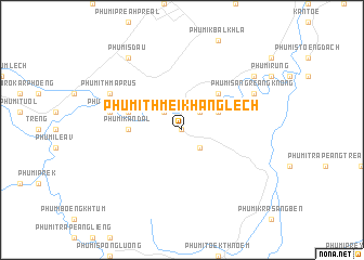
Phumĭ Thmei Khang Lĕch (Bătdâmbâng, Cambodia)Phumĭ Thmei Khang Lĕch is a town in the Bătdâmbâng region of Cambodia. An overview map of the region around Phumĭ Thmei Khang Lĕch is displayed below.
regional and 3d topo map of Phumĭ Thmei Khang Lĕch, Cambodia ::
Phumĭ Thmei Khang Lĕch airports ::
The nearest airport is REP - Siem-reap Siem Reap, located 107.1 km north east of Phumĭ Thmei Khang Lĕch.
Other airports nearby include PNH - Phnom-penh Phnom Penh Intl (242.0 km south east), Nearby towns ::
Phumĭ Thmei (0.0km north) //
Phumĭ Cha (2) (0.0km north) //
Phumĭ Cha (1) (2.6km north west) //
Phumĭ Kâmpóng Kól (2.6km north east) //
Phumĭ Vôtt (2.6km north east) //
Phumĭ Thmei Khang Kaeut (2.6km south east) //
Phumĭ Thméa (4.1km north east) //
Phumĭ Buŏr Spéan (5.2km north east) //
Phumĭ Kândal (5.4km west) //
Phumĭ Kónthlêv (5.7km west) //
Phumĭ Thvak (7.5km west) //
Phumĭ Thmâ Prŭs (8.1km north west) //
Phumĭ Kâmpóng Ta Kau (8.1km north west) //
Phumĭ Săng Reăng Knŏng (8.1km north east) //
Phumĭ Sdau (9.2km north west) //
Phumĭ Chângho Svay (9.1km north east) //
[all distances 'as the bird flies' and approximate]  Places with similar names to Phumĭ Thmei Khang Lĕch, Cambodia :: Disclaimer :: Information on this page comes without warranty of any kind |
||
|
Where is Phumĭ Thmei Khang Lĕch? Elevation and coordinates ::
Latitude (lat): 12°49'0"N Longitude (lon): 103°2'0"E
Elevation (approx.): 47m (map arrows pan, magnifying glasses zoom) |
||
|
Visiting Phumĭ Thmei Khang Lĕch? Hotel/Accommodation ::
Book a hotel in Phumĭ Thmei Khang Lĕch Travel Guide ::
Buy a travel guide for Cambodia rental cars ::
car rental offers GPS waypoint ::
download a GPX waypoint (PoI) of Phumĭ Thmei Khang Lĕch for your GPS receiver
|
||